Rāmpura night lights from space
Night Light of Rāmpura (Punjab) from space (India) Src. Average luminocity for 10x10km area is 37.9545% and for 50x50km: 16.9393%.
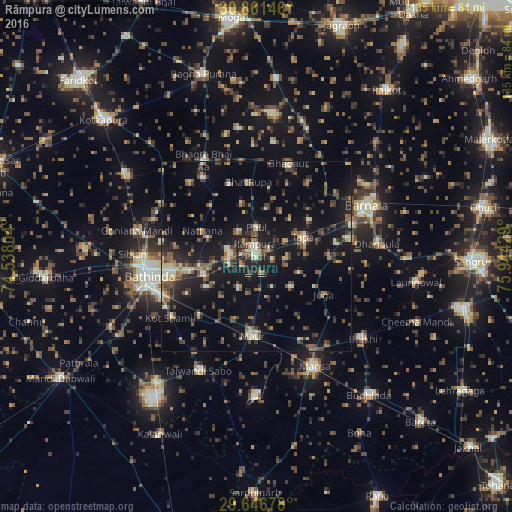
Analysis of Rāmpura night lights 2016
Square area 10x10 km:
 1.57%
1.57%90-99
6.82%80-89
4.2%70-79
4.9%60-69
4.72%50-59
7.17%40-49
7.17%30-39
9.27%20-29
18.71%10-19
34.79%0-9
0.7%Square area 50x50 km:
0.56%90-99
2.03%80-89
1.51%70-79
1.37%60-69
2.26%50-59
3.51%40-49
3.31%30-39
3.95%20-29
5.17%10-19
15.75%0-9
60.6%Clear (daylight) street map image can be seen on geolist.org.
Map coordinates:
30° 51' 41.3" North, 74° 32' 16.9" East
30° 15' 21.6" North, 75° 14' 28.2" East
29° 38' 48.4" North, 75° 56' 39.4" East
Some cities around Rāmpura sort by population:
• Bathinda
29.5 km =18.3 mi,  259°
259°
• Barnāla
32.3 km =20.1 mi,  65°
65°
• Mānsa
33.5 km =20.8 mi,  152°
152°
• Jaito
39.9 km =24.8 mi,  302°
302°
• Maur
19.2 km =11.9 mi,  177°
177°
• Dhanaula
32 km =19.9 mi,  84°
84°
• Bhadaur
26 km =16.2 mi,  19°
19°
• Bhīkhi
35.7 km =22.2 mi,  127°
127°
1258584 (p: 45,639)
Sources (retrieved 2019-11-25):
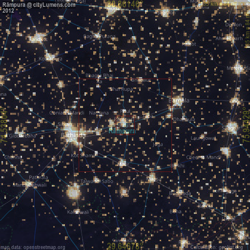
» Earth at Night: Flat Maps 2012, 2016