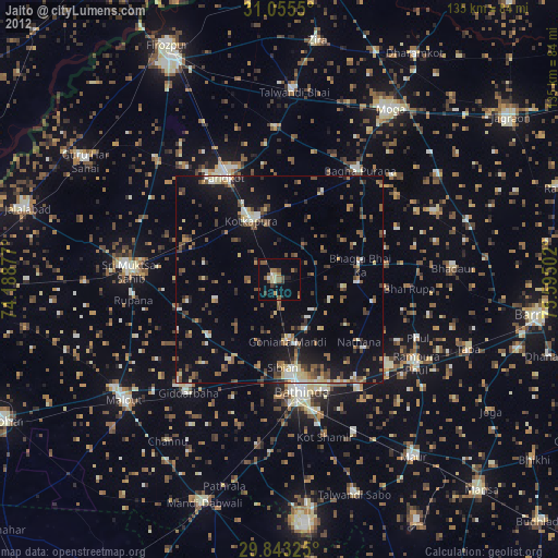
Jaito night lights from space
Night Light of Jaito (Punjab) from space (India) Src. Average luminocity for 10x10km area is 14.5989% and for 50x50km: 14.4417%.
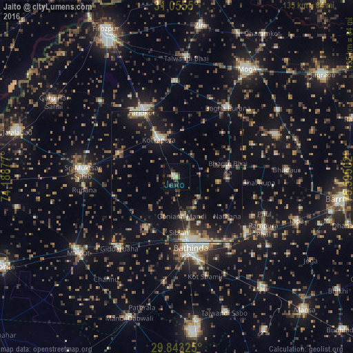
Analysis of Jaito night lights 2016
Square area 10x10 km:
 0%
0%90-99
2.38%80-89
2.75%70-79
0%60-69
1.83%50-59
2.2%40-49
3.66%30-39
3.11%20-29
2.56%10-19
3.48%0-9
78.02%Square area 50x50 km:
0.38%90-99
1.7%80-89
1.25%70-79
1.17%60-69
2.03%50-59
2.7%40-49
3.45%30-39
3.29%20-29
4.53%10-19
10.7%0-9
68.8%Clear (daylight) street map image can be seen on geolist.org.
Map coordinates:
31° 3' 19.8" North, 74° 11' 19.6" East
30° 27' 4.5" North, 74° 53' 30.8" East
29° 50' 35.7" North, 75° 35' 42.1" East
Some cities around Jaito sort by population:
• Bathinda
27.5 km =17.1 mi,  170°
170°
• Muktsar
36.1 km =22.4 mi,  274°
274°
• Kotkapura
15.6 km =9.7 mi,  338°
338°
• Farīdkot
28 km =17.4 mi,  332°
332°
• Rāmpura
39.9 km =24.8 mi,  122°
122°
• Giddarbāha
35.4 km =22 mi,  217°
217°
• Bāgha Purāna
32.9 km =20.4 mi,  36°
36°
• Bhadaur
42.1 km =26.2 mi,  86°
86°
1269488 (p: 34,346)
Sources (retrieved 2019-11-25):
» Earth at Night: Flat Maps 2012, 2016