Malaut night lights from space
Night Light of Malaut (Punjab) from space (India) Src. Average luminocity for 10x10km area is 26.7028% and for 50x50km: 9.5567%.
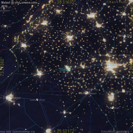
Analysis of Malaut night lights 2016
Square area 10x10 km:
 2.8%
2.8%90-99
5.59%80-89
2.8%70-79
1.92%60-69
4.37%50-59
5.07%40-49
2.62%30-39
3.85%20-29
1.92%10-19
30.42%0-9
38.64%Square area 50x50 km:
0.15%90-99
0.67%80-89
0.62%70-79
0.92%60-69
1.22%50-59
2.08%40-49
2.71%30-39
2.24%20-29
2.24%10-19
6.11%0-9
81.05%Clear (daylight) street map image can be seen on geolist.org.
Map coordinates:
30° 49' 1" North, 73° 46' 43.2" East
30° 12' 40.4" North, 74° 28' 54.5" East
29° 36' 6.2" North, 75° 11' 5.7" East
Some cities around Malaut sort by population:
• Bathinda
43.9 km =27.3 mi,  90°
90°
• Abohar
28.5 km =17.7 mi,  254°
254°
• Muktsar
29.4 km =18.3 mi,  6°
6°
• Fāzilka
48.4 km =30.1 mi,  295°
295°
• Dabwāli
38.2 km =23.7 mi,  139°
139°
• Giddarbāha
17.8 km =11.1 mi, 94°
• Sangariā
45.9 km =28.5 mi,  181°
181°
• Jaito
47.6 km =29.6 mi,  55°
55°
1264138 (p: 76,616)
Sources (retrieved 2019-11-25):
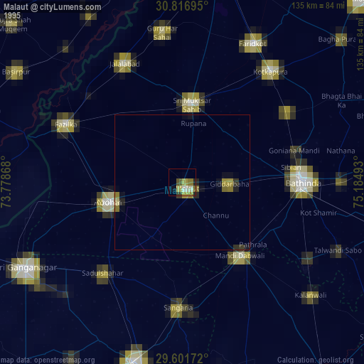
» NASA, Earths city lights 1995
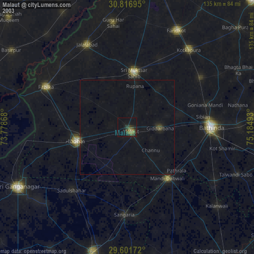
» NASA city lights 2003
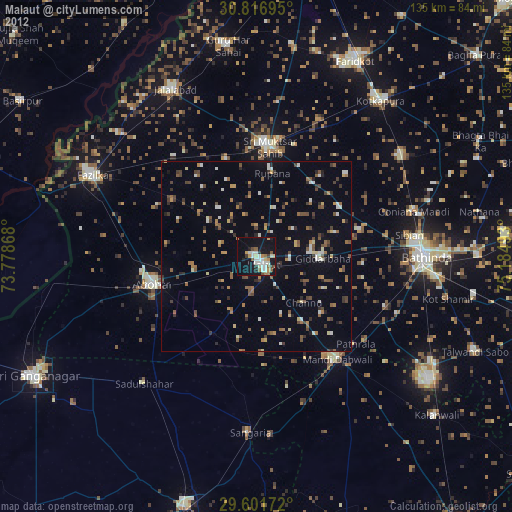
» Earth at Night: Flat Maps 2012, 2016