Wonosobo night lights from space
Night Light of Wonosobo (Central Java) from space (Indonesia) Src. Average luminocity for 10x10km area is 18.3615% and for 50x50km: 2.9657%.
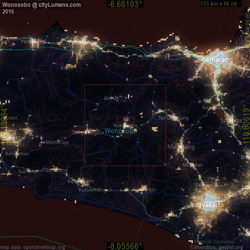
Analysis of Wonosobo night lights 2016
Square area 10x10 km:
 0.87%
0.87%90-99
2.16%80-89
3.25%70-79
0.65%60-69
3.46%50-59
0.87%40-49
6.06%30-39
3.46%20-29
6.93%10-19
4.55%0-9
67.75%Square area 50x50 km:
0.03%90-99
0.23%80-89
0.67%70-79
0.24%60-69
0.44%50-59
0.44%40-49
0.54%30-39
0.6%20-29
1.01%10-19
0.62%0-9
95.17%Clear (daylight) street map image can be seen on geolist.org.
Map coordinates:
6° 39' 39.7" South, 109° 11' 59.8" East
7° 21' 32" South, 109° 54' 11" East
8° 3' 20.4" South, 110° 36' 22.3" East
Some cities around Wonosobo sort by population:
• Kedungwuni
51.6 km =32.1 mi,  326°
326°
• Magelang
36.9 km =22.9 mi,  109°
109°
• Mertoyudan
39.9 km =24.8 mi,  116°
116°
• Weleri
46.7 km =29 mi,  22°
22°
• Muntilan
49.6 km =30.8 mi, 119°
• Buaran
51.9 km =32.2 mi,  311°
311°
• Gombong
51 km =31.7 mi,  237°
237°
• Kutoarjo
39.8 km =24.7 mi,  178°
178°
1621395 (p: 92,990)
Sources (retrieved 2019-11-25):
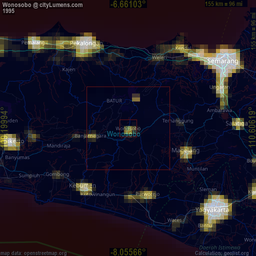
» NASA, Earths city lights 1995
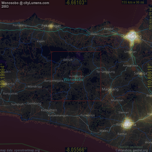
» NASA city lights 2003
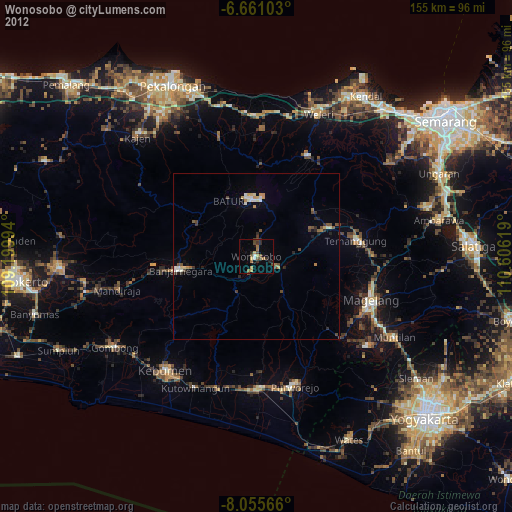
» Earth at Night: Flat Maps 2012, 2016