Wiradesa night lights from space
Night Light of Wiradesa (Central Java) from space (Indonesia) Src. Average luminocity for 10x10km area is 40.9113% and for 50x50km: 7.4582%.
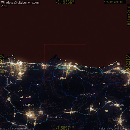
Analysis of Wiradesa night lights 2016
Square area 10x10 km:
 1.73%
1.73%90-99
5.63%80-89
4.11%70-79
4.76%60-69
7.79%50-59
11.04%40-49
9.74%30-39
14.72%20-29
8.87%10-19
29.22%0-9
2.38%Square area 50x50 km:
0.19%90-99
0.58%80-89
0.78%70-79
0.76%60-69
1.25%50-59
1.79%40-49
2.07%30-39
2.02%20-29
2.23%10-19
5.77%0-9
82.55%Clear (daylight) street map image can be seen on geolist.org.
Map coordinates:
6° 11' 37.2" South, 108° 54' 57.2" East
6° 53' 31.9" South, 109° 37' 8.4" East
7° 35' 23" South, 110° 19' 19.7" East
Some cities around Wiradesa sort by population:
• Pekalongan
6.2 km =3.9 mi,  86°
86°
• Pemalang
26.1 km =16.2 mi,  270°
270°
• Kedungwuni
9.3 km =5.8 mi,  159°
159°
• Tarub
50.1 km =31.1 mi,  264°
264°
• Comal
9.4 km =5.8 mi, 261°
• Buaran
19.1 km =11.9 mi,  203°
203°
• Wonopringgo
10.1 km =6.3 mi,  181°
181°
• Randudongkal
39.8 km =24.7 mi,  234°
234°
1621520 (p: 39,407)
Sources (retrieved 2019-11-25):
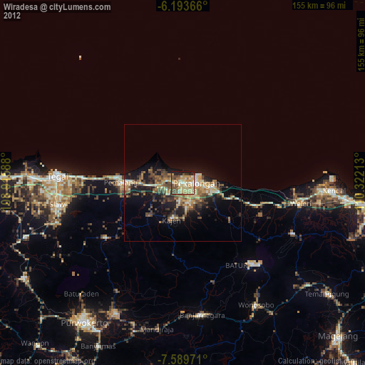
» Earth at Night: Flat Maps 2012, 2016