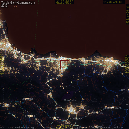
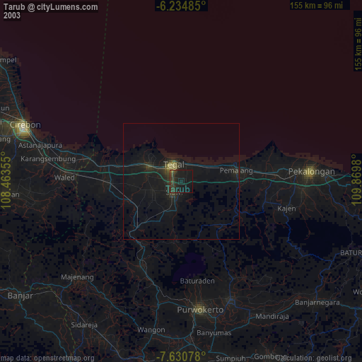
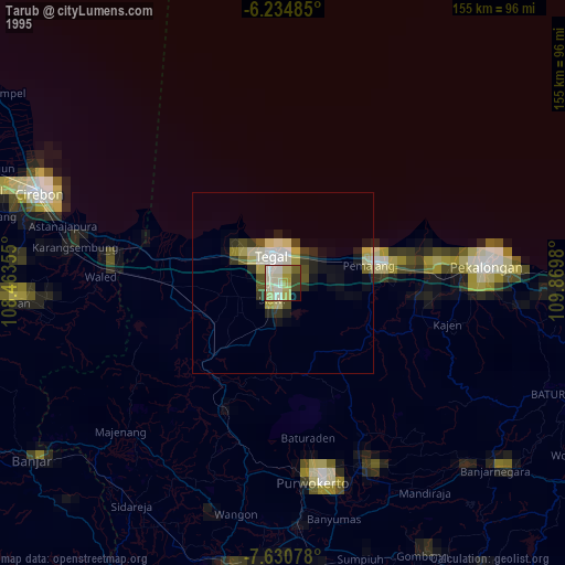
Tarub night lights from space
Night Light of Tarub (Central Java) from space (Indonesia) Src. Average luminocity for 10x10km area is 52.2879% and for 50x50km: 12.5938%.
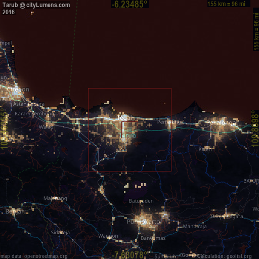
Analysis of Tarub night lights 2016
Square area 10x10 km:
 2.16%
2.16%90-99
6.28%80-89
7.14%70-79
4.98%60-69
16.88%50-59
16.67%40-49
13.85%30-39
14.5%20-29
8.44%10-19
8.44%0-9
0.65%Square area 50x50 km:
0.67%90-99
1.29%80-89
1.15%70-79
1.14%60-69
2.37%50-59
3.09%40-49
3.44%30-39
3.5%20-29
3.87%10-19
7.94%0-9
71.54%Clear (daylight) street map image can be seen on geolist.org.
Map coordinates:
6° 14' 5.5" South, 108° 27' 48.8" East
6° 55' 60" South, 109° 10' 0" East
7° 37' 50.8" South, 109° 52' 11.3" East
Some cities around Tarub sort by population:
• Tegal
7.7 km =4.8 mi,  337°
337°
• Pemalang
24.3 km =15.1 mi,  79°
79°
• Adiwerna
3.8 km =2.4 mi,  262°
262°
• Dukuhturi
9.9 km =6.2 mi,  291°
291°
• Slawi
6.1 km =3.8 mi,  208°
208°
• Lebaksiu
13.2 km =8.2 mi,  190°
190°
• Balapulang
14.7 km =9.1 mi, 209°
• Bulakamba
24.2 km =15 mi, 285°
1624668 (p: 75,739)
Sources (retrieved 2019-11-25):
» NASA, Earths city lights 1995
» NASA city lights 2003
» Earth at Night: Flat Maps 2012, 2016