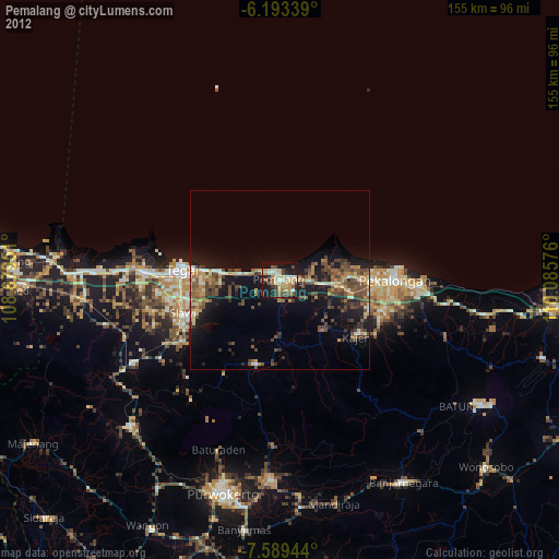
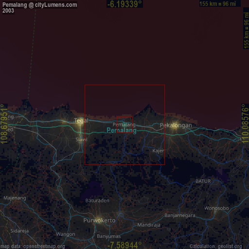
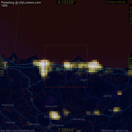
Pemalang night lights from space
Night Light of Pemalang (Central Java) from space (Indonesia) Src. Average luminocity for 10x10km area is 27.2013% and for 50x50km: 5.3375%.
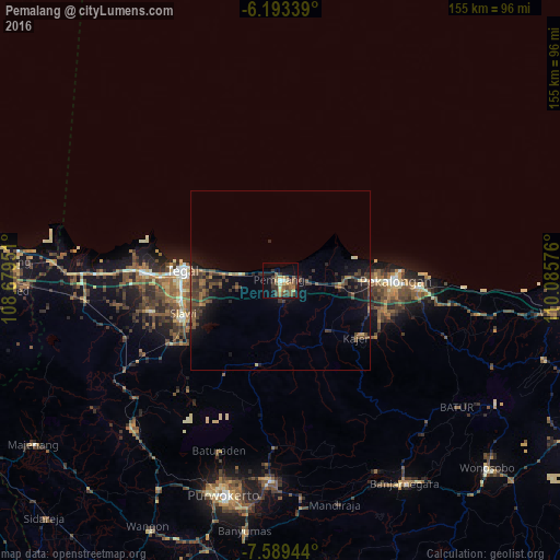
Analysis of Pemalang night lights 2016
Square area 10x10 km:
 0.65%
0.65%90-99
1.73%80-89
3.03%70-79
4.55%60-69
5.19%50-59
8.01%40-49
5.41%30-39
9.09%20-29
5.63%10-19
16.02%0-9
40.69%Square area 50x50 km:
0.03%90-99
0.17%80-89
0.3%70-79
0.44%60-69
0.93%50-59
1.06%40-49
1.85%30-39
2.02%20-29
1.83%10-19
4.66%0-9
86.7%Clear (daylight) street map image can be seen on geolist.org.
Map coordinates:
6° 11' 36.2" South, 108° 40' 46.2" East
6° 53' 30.9" South, 109° 22' 57.5" East
7° 35' 22" South, 110° 5' 8.7" East
Some cities around Pemalang sort by population:
• Tegal
26.9 km =16.7 mi,  275°
275°
• Adiwerna
28.1 km =17.5 mi,  259°
259°
• Tarub
24.3 km =15.1 mi, 259°
• Comal
16.9 km =10.5 mi,  95°
95°
• Wiradesa
26.1 km =16.2 mi,  90°
90°
• Buaran
25.5 km =15.8 mi,  133°
133°
• Wonopringgo
27.8 km =17.3 mi,  111°
111°
• Randudongkal
23.8 km =14.8 mi,  195°
195°
1631648 (p: 184,149)
Sources (retrieved 2019-11-25):
» NASA, Earths city lights 1995
» NASA city lights 2003
» Earth at Night: Flat Maps 2012, 2016