Martapura night lights from space
Night Light of Martapura (South Kalimantan) from space (Indonesia) Src. Average luminocity for 10x10km area is 30.5325% and for 50x50km: 5.3811%.
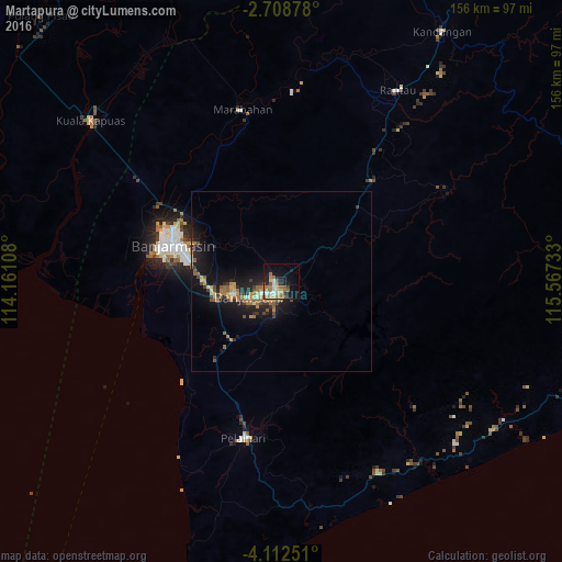
Analysis of Martapura night lights 2016
Square area 10x10 km:
 3.25%
3.25%90-99
4.33%80-89
4.11%70-79
4.55%60-69
9.52%50-59
5.84%40-49
1.73%30-39
1.3%20-29
3.68%10-19
21.86%0-9
39.83%Square area 50x50 km:
0.15%90-99
0.52%80-89
0.41%70-79
1.03%60-69
1.25%50-59
1.11%40-49
0.55%30-39
0.66%20-29
1.54%10-19
6.33%0-9
86.45%Clear (daylight) street map image can be seen on geolist.org.
Map coordinates:
2° 42' 31.6" South, 114° 9' 39.9" East
3° 24' 39.2" South, 114° 51' 51.1" East
4° 6' 45" South, 115° 34' 2.4" East
Some cities around Martapura sort by population:
• City of Balikpapan
330.2 km =205.2 mi,  43°
43°
• Banjarmasin
32 km =19.9 mi,  288°
288°
• Balikpapan
323.2 km =200.8 mi, 42°
• Palangkaraya
170.2 km =105.8 mi,  321°
321°
• Sampit
234 km =145.4 mi, 294°
• Barabai
108.6 km =67.5 mi,  32°
32°
• Amuntai
118.4 km =73.6 mi,  21°
21°
• Kualakapuas
69.2 km =43 mi,  310°
310°
1636022 (p: 131,449)
Sources (retrieved 2019-11-25):
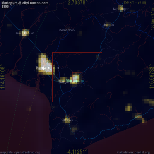
» NASA, Earths city lights 1995
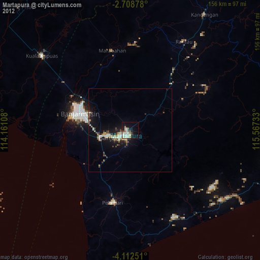
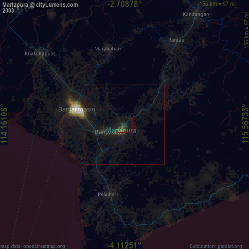
» NASA city lights 2003
» Earth at Night: Flat Maps 2012, 2016