Tela night lights from space
Night Light of Tela (Atlántida) from space (Honduras) Src. Average luminocity for 10x10km area is 24.868% and for 50x50km: 1.7587%.
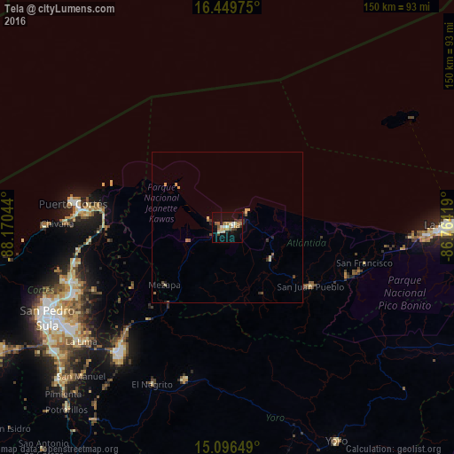
Analysis of Tela night lights 2016
Square area 10x10 km:
 1.73%
1.73%90-99
5.41%80-89
3.68%70-79
1.3%60-69
5.41%50-59
3.9%40-49
2.6%30-39
3.03%20-29
1.52%10-19
21%0-9
50.43%Square area 50x50 km:
0.07%90-99
0.21%80-89
0.37%70-79
0.16%60-69
0.33%50-59
0.25%40-49
0.23%30-39
0.28%20-29
0.28%10-19
0.91%0-9
96.91%Clear (daylight) street map image can be seen on geolist.org.
Map coordinates:
16° 26' 59.1" North, 88° 10' 13.6" West
15° 46' 27.3" North, 87° 28' 2.3" West
15° 5' 47.4" North, 86° 45' 51.1" West
Some cities around Tela sort by population:
• Choloma
54.9 km =34.1 mi,  251°
251°
• El Progreso
54.8 km =34.1 mi,  220°
220°
• Puerto Cortez
49.8 km =30.9 mi,  276°
276°
• Morazán
52.8 km =32.8 mi,  195°
195°
• El Negrito
56.7 km =35.2 mi,  206°
206°
• Baracoa
41 km =25.5 mi,  268°
268°
• Mezapa
28.9 km =18 mi, 222°
• San Juan Pueblo
32.8 km =20.4 mi,  130°
130°
3600931 (p: 29,325)
Sources (retrieved 2019-11-25):
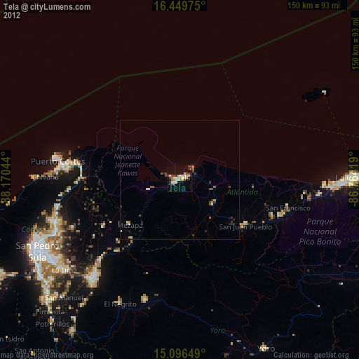
» Earth at Night: Flat Maps 2012, 2016