San Juan Pueblo night lights from space
Night Light of San Juan Pueblo (Atlántida) from space (Honduras) Src. Average luminocity for 10x10km area is 5.8983% and for 50x50km: 1.311%.
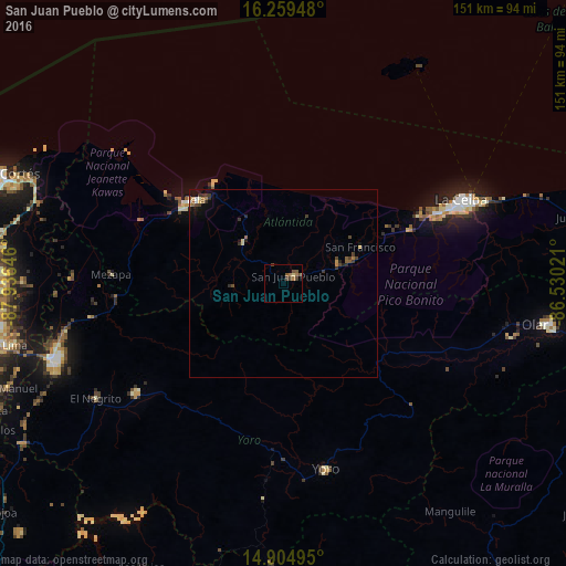
Analysis of San Juan Pueblo night lights 2016
Square area 10x10 km:
 0%
0%90-99
0%80-89
0.87%70-79
0%60-69
2.6%50-59
1.73%40-49
3.25%30-39
1.52%20-29
0%10-19
0%0-9
90.04%Square area 50x50 km:
0.04%90-99
0.08%80-89
0.19%70-79
0.07%60-69
0.29%50-59
0.25%40-49
0.38%30-39
0.46%20-29
0.28%10-19
0.5%0-9
97.46%Clear (daylight) street map image can be seen on geolist.org.
Map coordinates:
16° 15' 34.1" North, 87° 56' 11.3" West
15° 34' 60" North, 87° 13' 60" West
14° 54' 17.8" North, 86° 31' 48.8" West
Some cities around San Juan Pueblo sort by population:
• La Ceiba
52.1 km =32.4 mi,  67°
67°
• El Progreso
64 km =39.8 mi,  251°
251°
• Tela
32.8 km =20.4 mi,  310°
310°
• Yoro
50.8 km =31.6 mi,  167°
167°
• Santa Rita
46.6 km =29 mi,  186°
186°
• Morazán
49.2 km =30.6 mi,  232°
232°
• El Negrito
58.1 km =36.1 mi,  239°
239°
• Mezapa
44.6 km =27.7 mi,  270°
270°
3601984 (p: 5,735)
Sources (retrieved 2019-11-25):
» Earth at Night: Flat Maps 2012, 2016