El Progreso night lights from space
Night Light of El Progreso (Yoro) from space (Honduras) Src. Average luminocity for 10x10km area is 44.9848% and for 50x50km: 18.6561%.
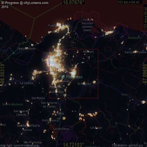
Analysis of El Progreso night lights 2016
Square area 10x10 km:
 6.93%
6.93%90-99
8.66%80-89
7.79%70-79
6.93%60-69
2.6%50-59
2.38%40-49
9.96%30-39
8.01%20-29
11.26%10-19
33.77%0-9
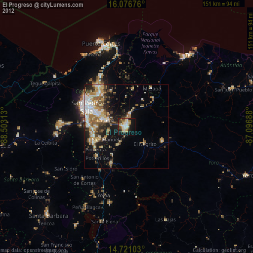
1.73%Square area 50x50 km:
2.25%90-99
3.32%80-89
2.85%70-79
2.71%60-69
2.86%50-59
2.98%40-49
2.85%30-39
3.11%20-29
4.15%10-19
8.33%0-9
64.59%Clear (daylight) street map image can be seen on geolist.org.
Map coordinates:
16° 4' 36.3" North, 88° 30' 11.3" West
15° 24' 0" North, 87° 48' 0" West
14° 43' 15.7" North, 87° 5' 48.8" West
Some cities around El Progreso sort by population:
• La Lima
13 km =8.1 mi,  286°
286°
• Villanueva
23.4 km =14.5 mi,  246°
246°
• Potrerillos
25.7 km =16 mi,  223°
223°
• Morazán
23.4 km =14.5 mi,  113°
113°
• El Negrito
14.2 km =8.8 mi,  130°
130°
• Pimienta Vieja
25.7 km =16 mi, 223°
• Agua Blanca Sur
18.9 km =11.7 mi,  208°
208°
• San Manuel
14.5 km =9 mi,  239°
239°
3610613 (p: 100,810)
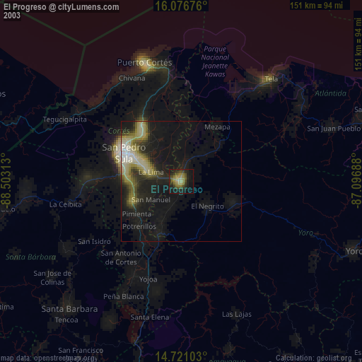
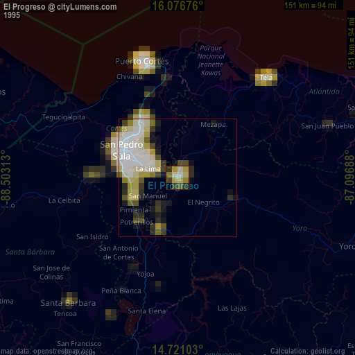
Sources (retrieved 2019-11-25):
» NASA, Earths city lights 1995
» NASA city lights 2003
» Earth at Night: Flat Maps 2012, 2016