Mezapa night lights from space
Night Light of Mezapa (Atlántida) from space (Honduras) Src. Average luminocity for 10x10km area is 3.3658% and for 50x50km: 4.9292%.
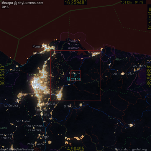
Analysis of Mezapa night lights 2016
Square area 10x10 km:
 0%
0%90-99
0%80-89
0.87%70-79
0%60-69
0.87%50-59
0.87%40-49
0.87%30-39
0%20-29
2.6%10-19
0.87%0-9
93.07%Square area 50x50 km:
0.33%90-99
0.57%80-89
0.7%70-79
0.39%60-69
0.62%50-59
0.72%40-49
0.9%30-39
0.87%20-29
1.21%10-19
5.62%0-9
88.08%Clear (daylight) street map image can be seen on geolist.org.
Map coordinates:
16° 15' 34.1" North, 88° 21' 11.3" West
15° 34' 60" North, 87° 39' 0" West
14° 54' 17.8" North, 86° 56' 48.8" West
Some cities around Mezapa sort by population:
• Choloma
32.6 km =20.3 mi,  276°
276°
• El Progreso
26 km =16.2 mi,  218°
218°
• La Lima
33.1 km =20.6 mi,  239°
239°
• Tela
28.9 km =18 mi,  42°
42°
• Morazán
30.1 km =18.7 mi,  169°
169°
• El Negrito
30.1 km =18.7 mi,  190°
190°
• Baracoa
29.6 km =18.4 mi,  313°
313°
• San Manuel
39.9 km =24.8 mi,  225°
225°
3604835 (p: 6,324)
Sources (retrieved 2019-11-25):
» Earth at Night: Flat Maps 2012, 2016