Santa Rita night lights from space
Night Light of Santa Rita (Yoro) from space (Honduras) Src. Average luminocity for 10x10km area is 0.4855% and for 50x50km: 0.3533%.
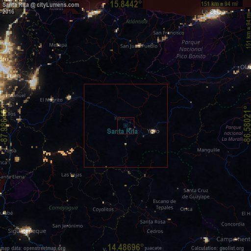
Analysis of Santa Rita night lights 2016
Square area 10x10 km:
 0%
0%90-99
0%80-89
0%70-79
0%60-69
0%50-59
0%40-49
0.62%30-39
0.21%20-29
0%10-19
0.83%0-9
98.35%Square area 50x50 km:
0%90-99
0.02%80-89
0.12%70-79
0.03%60-69
0.04%50-59
0.06%40-49
0.06%30-39
0.17%20-29
0.02%10-19
0.1%0-9
99.39%Clear (daylight) street map image can be seen on geolist.org.
Map coordinates:
15° 50' 39.1" North, 87° 59' 11.3" West
15° 10' 0" North, 87° 16' 60" West
14° 29' 13.1" North, 86° 34' 48.8" West
Some cities around Santa Rita sort by population:
• El Progreso
61.2 km =38 mi,  295°
295°
• Yoro
17 km =10.6 mi,  100°
100°
• Morazán
37.8 km =23.5 mi, 296°
• El Negrito
47.7 km =29.6 mi,  290°
290°
• Agua Blanca Sur
65 km =40.4 mi,  278°
278°
• San Manuel
70.4 km =43.7 mi, 285°
• Mezapa
60.8 km =37.8 mi,  319°
319°
• San Juan Pueblo
46.6 km =29 mi,  6°
6°
3601517 (p: 12,869)
Sources (retrieved 2019-11-25):
» Earth at Night: Flat Maps 2012, 2016