Totonicapán night lights from space
Night Light of Totonicapán from space (Guatemala) Src. Average luminocity for 10x10km area is 18.5806% and for 50x50km: 8.2708%.
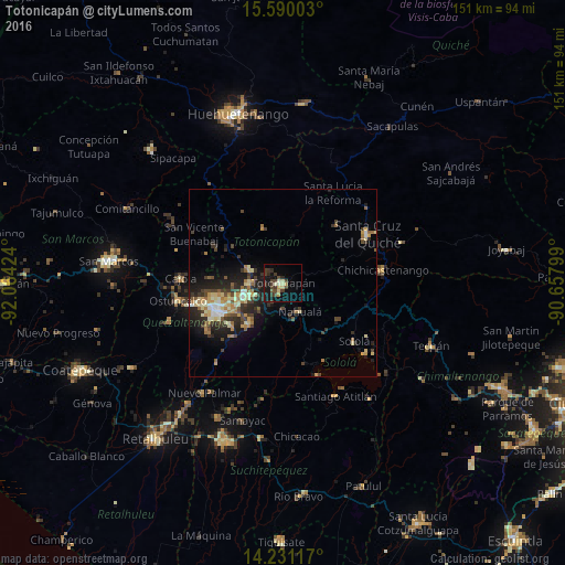
Analysis of Totonicapán night lights 2016
Square area 10x10 km:
 0%
0%90-99
2.48%80-89
3.31%70-79
2.27%60-69
0.21%50-59
0.83%40-49
6.82%30-39
7.64%20-29
3.31%10-19
16.32%0-9
56.82%Square area 50x50 km:
0.41%90-99
1.14%80-89
1.53%70-79
0.97%60-69
1.3%50-59
0.87%40-49
1.46%30-39
1.97%20-29
2.86%10-19
5.14%0-9
82.35%Clear (daylight) street map image can be seen on geolist.org.
Map coordinates:
15° 35' 24.1" North, 92° 3' 51.3" West
14° 54' 42" North, 91° 21' 40" West
14° 13' 52.2" North, 90° 39' 28.8" West
Some cities around Totonicapán sort by population:
• San Francisco El Alto
9.6 km =6 mi,  292°
292°
• Momostenango
15.6 km =9.7 mi,  340°
340°
• Nahualá
8.9 km =5.5 mi,  148°
148°
• Cantel
15.1 km =9.4 mi,  222°
222°
• Santa Catarina Ixtahuacán
12.6 km =7.8 mi,  178°
178°
• San Andrés Xecul
13.1 km =8.1 mi,  266°
266°
• Salcajá
10.9 km =6.8 mi,  250°
250°
• Santa María Chiquimula
13.6 km =8.5 mi,  14°
14°
3588258 (p: 69,734)
Sources (retrieved 2019-11-25):
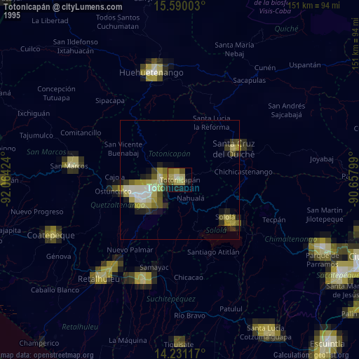
» NASA, Earths city lights 1995
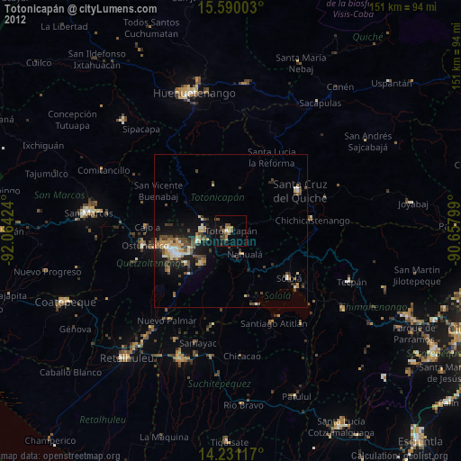
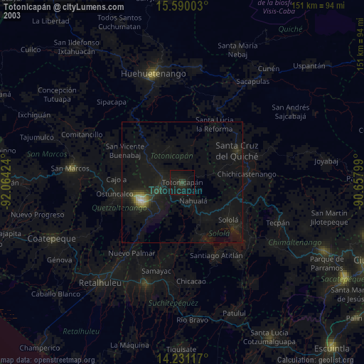
» NASA city lights 2003
» Earth at Night: Flat Maps 2012, 2016