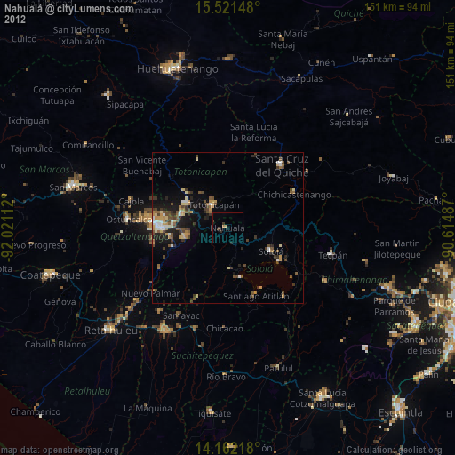
Nahualá night lights from space
Night Light of Nahualá (Sololá) from space (Guatemala) Src. Average luminocity for 10x10km area is 5.1302% and for 50x50km: 7.808%.
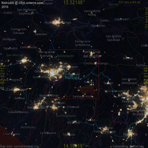
Analysis of Nahualá night lights 2016
Square area 10x10 km:
 0%
0%90-99
0%80-89
0.83%70-79
0%60-69
0.83%50-59
0.83%40-49
1.03%30-39
1.65%20-29
1.86%10-19
2.69%0-9
90.29%Square area 50x50 km:
0.38%90-99
1.03%80-89
1.41%70-79
0.99%60-69
1.24%50-59
0.83%40-49
1.55%30-39
1.88%20-29
2.41%10-19
4.22%0-9
84.06%Clear (daylight) street map image can be seen on geolist.org.
Map coordinates:
15° 31' 17.3" North, 92° 1' 16" West
14° 50' 34.4" North, 91° 19' 4.8" West
14° 9' 43.8" North, 90° 36' 53.5" West
Some cities around Nahualá sort by population:
• Totonicapán
8.9 km =5.5 mi,  328°
328°
• Sololá
16.5 km =10.3 mi,  118°
118°
• Cantel
15.2 km =9.4 mi,  256°
256°
• Santa Catarina Ixtahuacán
6.6 km =4.1 mi,  221°
221°
• Salcajá
15.5 km =9.6 mi,  285°
285°
• San Pedro La Laguna
17.4 km =10.8 mi,  163°
163°
• San Pablo La Laguna
14.4 km =8.9 mi, 160°
• Santa Clara La Laguna
14.3 km =8.9 mi,  173°
173°
3592286 (p: 27,690)
Sources (retrieved 2019-11-25):
» Earth at Night: Flat Maps 2012, 2016