San Andrés Xecul night lights from space
Night Light of San Andrés Xecul (Totonicapán) from space (Guatemala) Src. Average luminocity for 10x10km area is 44.1798% and for 50x50km: 8.5596%.
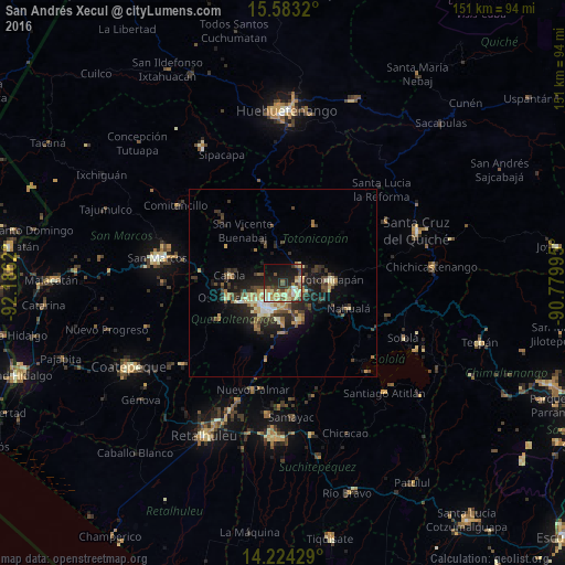
Analysis of San Andrés Xecul night lights 2016
Square area 10x10 km:
 1.65%
1.65%90-99
9.71%80-89
12.6%70-79
3.72%60-69
7.44%50-59
5.58%40-49
5.17%30-39
7.23%20-29
14.46%10-19
20.04%0-9
12.4%Square area 50x50 km:
0.37%90-99
1.18%80-89
1.42%70-79
0.96%60-69
1.37%50-59
0.86%40-49
1.58%30-39
2.31%20-29
2.99%10-19
5.98%0-9
80.98%Clear (daylight) street map image can be seen on geolist.org.
Map coordinates:
15° 34' 59.5" North, 92° 11' 10.3" West
14° 54' 17.4" North, 91° 28' 59.1" West
14° 13' 27.4" North, 90° 46' 47.8" West
Some cities around San Andrés Xecul sort by population:
• Quetzaltenango
8.7 km =5.4 mi,  205°
205°
• San Francisco El Alto
6.2 km =3.9 mi,  43°
43°
• Cantel
10.8 km =6.7 mi,  163°
163°
• La Esperanza
9.2 km =5.7 mi,  246°
246°
• Salcajá
4 km =2.5 mi,  134°
134°
• Almolonga
10 km =6.2 mi,  187°
187°
• San Carlos Sija
11.3 km =7 mi,  321°
321°
• San Mateo
12.6 km =7.8 mi, 245°
3590520 (p: 12,133)
Sources (retrieved 2019-11-25):
» Earth at Night: Flat Maps 2012, 2016