La Gomera night lights from space
Night Light of La Gomera (Escuintla) from space (Guatemala) Src. Average luminocity for 10x10km area is 1.1905% and for 50x50km: 1.1321%.
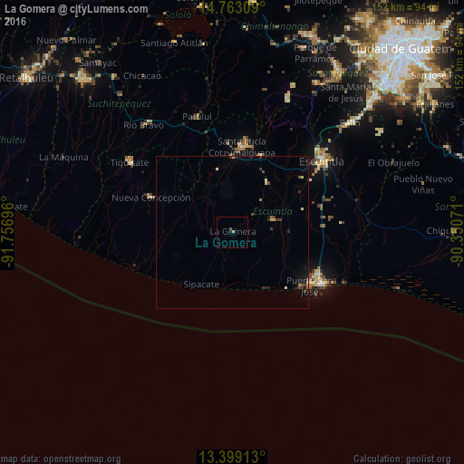

Analysis of La Gomera night lights 2016
Square area 10x10 km:
 0%
0%90-99
0%80-89
0%70-79
0.43%60-69
0.43%50-59
0%40-49
0.87%30-39
0%20-29
0.43%10-19
0.43%0-9
97.4%Square area 50x50 km:
0%90-99
0.13%80-89
0.12%70-79
0.17%60-69
0.08%50-59
0.1%40-49
0.28%30-39
0.28%20-29
0.29%10-19
0.68%0-9
97.86%Clear (daylight) street map image can be seen on geolist.org.
Map coordinates:
14° 45' 47.1" North, 91° 45' 25.1" West
14° 4' 55.7" North, 91° 3' 13.8" West
13° 23' 56.9" North, 90° 21' 2.6" West
Some cities around La Gomera sort by population:
• Escuintla
38.1 km =23.7 mi,  49°
49°
• Santa Lucía Cotzumalguapa
28.3 km =17.6 mi,  6°
6°
• Puerto San José
30.4 km =18.9 mi,  124°
124°
• Tiquisate
39.9 km =24.8 mi,  304°
304°
• Patulul
39.6 km =24.6 mi,  343°
343°
• Nueva Concepción
29.6 km =18.4 mi, 296°
• Masagua
25.9 km =16.1 mi,  58°
58°
• La Democracia
20.1 km =12.5 mi,  34°
34°
3594575 (p: 24,001)
Sources (retrieved 2019-11-25):
» Earth at Night: Flat Maps 2012, 2016