Puerto San José night lights from space
Night Light of Puerto San José (Escuintla) from space (Guatemala) Src. Average luminocity for 10x10km area is 30.781% and for 50x50km: 2.2083%.
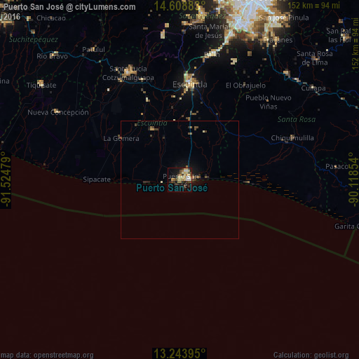
Analysis of Puerto San José night lights 2016
Square area 10x10 km:
 2.27%
2.27%90-99
4.55%80-89
8.68%70-79
3.93%60-69
3.1%50-59
2.89%40-49
6.2%30-39
4.75%20-29
5.37%10-19
20.66%0-9
37.6%Square area 50x50 km:
0.09%90-99
0.26%80-89
0.4%70-79
0.23%60-69
0.29%50-59
0.26%40-49
0.54%30-39
0.38%20-29
0.52%10-19
1.64%0-9
95.4%Clear (daylight) street map image can be seen on geolist.org.
Map coordinates:
14° 36' 31.8" North, 91° 31' 29.2" West
13° 55' 38.6" North, 90° 49' 18" West
13° 14' 38.2" North, 90° 7' 6.7" West
Some cities around Puerto San José sort by population:
• Escuintla
42.2 km =26.2 mi,  5°
5°
• Santa Lucía Cotzumalguapa
50.3 km =31.3 mi,  334°
334°
• La Gomera
30.4 km =18.9 mi,  304°
304°
• Chiquimulilla
50.2 km =31.2 mi,  69°
69°
• Masagua
30.8 km =19.1 mi,  354°
354°
• Guazacapán
46.6 km =29 mi, 69°
• Taxisco
41.2 km =25.6 mi, 67°
• La Democracia
36.4 km =22.6 mi,  338°
338°
3591060 (p: 18,655)
Sources (retrieved 2019-11-25):
» Earth at Night: Flat Maps 2012, 2016