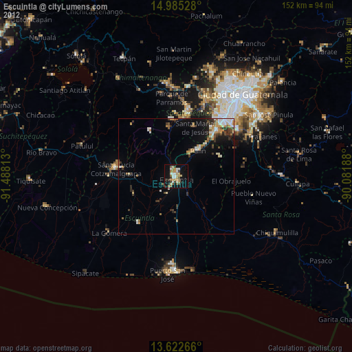
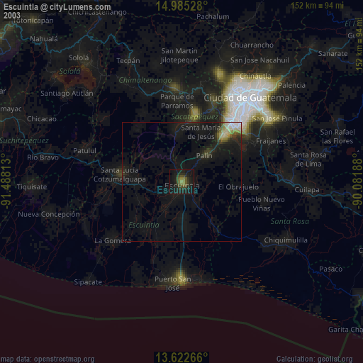
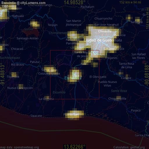
Escuintla night lights from space
Night Light of Escuintla from space (Guatemala) Src. Average luminocity for 10x10km area is 33.5476% and for 50x50km: 7.9317%.
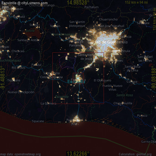
Analysis of Escuintla night lights 2016
Square area 10x10 km:
 0.87%
0.87%90-99
4.33%80-89
8.44%70-79
5.19%60-69
6.93%50-59
6.93%40-49
4.11%30-39
1.73%20-29
2.6%10-19
38.96%0-9
19.91%Square area 50x50 km:
0.56%90-99
1.25%80-89
1.48%70-79
0.88%60-69
0.93%50-59
0.94%40-49
1.16%30-39
1.34%20-29
1.34%10-19
5.78%0-9
84.35%Clear (daylight) street map image can be seen on geolist.org.
Map coordinates:
14° 59' 7" North, 91° 29' 17.3" West
14° 18' 18" North, 90° 47' 6" West
13° 37' 21.6" North, 90° 4' 54.8" West
Some cities around Escuintla sort by population:
• Palín
14.5 km =9 mi,  40°
40°
• Ciudad Vieja
24.5 km =15.2 mi,  5°
5°
• Alotenango
19.6 km =12.2 mi,  352°
352°
• Santa María de Jesús
22.6 km =14 mi,  20°
20°
• Masagua
13.2 km =8.2 mi,  210°
210°
• San Miguel Dueñas
24.2 km =15 mi,  356°
356°
• San Vicente Pacaya
20.1 km =12.5 mi,  52°
52°
• La Democracia
19.3 km =12 mi,  244°
244°
3595803 (p: 103,165)
Sources (retrieved 2019-11-25):
» NASA, Earths city lights 1995
» NASA city lights 2003
» Earth at Night: Flat Maps 2012, 2016