Nueva Concepción night lights from space
Night Light of Nueva Concepción (Escuintla) from space (Guatemala) Src. Average luminocity for 10x10km area is 3.2532% and for 50x50km: 0.713%.
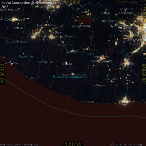
Analysis of Nueva Concepción night lights 2016
Square area 10x10 km:
 0%
0%90-99
0.22%80-89
0.65%70-79
0.87%60-69
0.87%50-59
0.87%40-49
0.43%30-39
0.43%20-29
0.65%10-19
0.22%0-9
94.81%Square area 50x50 km:
0%90-99
0.08%80-89
0.14%70-79
0.13%60-69
0.13%50-59
0.07%40-49
0.13%30-39
0.18%20-29
0.19%10-19
0.04%0-9
98.9%Clear (daylight) street map image can be seen on geolist.org.
Map coordinates:
14° 52' 50.2" North, 92° 0' 11.3" West
14° 12' 0" North, 91° 18' 0" West
13° 31' 2.5" North, 90° 35' 48.8" West
Some cities around Nueva Concepción sort by population:
• Santa Lucía Cotzumalguapa
33.4 km =20.8 mi,  63°
63°
• La Gomera
29.6 km =18.4 mi,  116°
116°
• Tiquisate
11.4 km =7.1 mi,  324°
324°
• Patulul
29 km =18 mi,  31°
31°
• Santa Bárbara
27.4 km =17 mi,  16°
16°
• Río Bravo
22.4 km =13.9 mi,  355°
355°
• Santo Domingo Suchitepéquez
36.8 km =22.9 mi,  327°
327°
• La Democracia
38.2 km =23.7 mi,  84°
84°
3592145 (p: 11,121)
Sources (retrieved 2019-11-25):
» Earth at Night: Flat Maps 2012, 2016