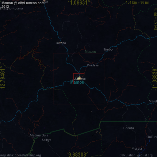
Mamou night lights from space
Night Light of Mamou from space (Guinea) Src. Average luminocity for 10x10km area is 11.0062% and for 50x50km: 0.4654%.
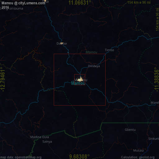
Analysis of Mamou night lights 2016
Square area 10x10 km:
100  0%
0%
90-99 0%
80-89 1.65%
70-79 4.96%
60-69 2.27%
50-59 1.03%
40-49 2.48%
30-39 0.83%
20-29 2.48%
10-19 0%
0-9 84.3%
0%90-99
0%80-89
1.65%70-79
4.96%60-69
2.27%50-59
1.03%40-49
2.48%30-39
0.83%20-29
2.48%10-19
0%0-9
84.3%Square area 50x50 km:
100 0%
90-99 0%
80-89 0.07%
70-79 0.2%
60-69 0.09%
50-59 0.04%
40-49 0.1%
30-39 0.03%
20-29 0.1%
10-19 0%
0-9 99.36%
0%90-99
0%80-89
0.07%70-79
0.2%60-69
0.09%50-59
0.04%40-49
0.1%30-39
0.03%20-29
0.1%10-19
0%0-9
99.36%Clear (daylight) street map image can be seen on geolist.org.
Map coordinates:
11° 3' 58.7" North, 12° 47' 40.6" West
10° 22' 31.7" North, 12° 5' 29.3" West
9° 40' 59.1" North, 11° 23' 18.1" West
Some cities around Mamou sort by population:
• Kindia
91.8 km =57 mi,  247°
247°
• Labé
106.9 km =66.4 mi,  348°
348°
• Télimélé
118.3 km =73.5 mi,  299°
299°
• Pita
82.9 km =51.5 mi,  336°
336°
• Kabala, SL
105.5 km =65.6 mi,  145°
145°
• Dabola
115 km =71.5 mi,  69°
69°
• Kamakwie, SL
99 km =61.5 mi,  189°
189°
• Dalaba
39.3 km =24.4 mi,  333°
333°
2417833 (p: 41,619)
Sources (retrieved 2019-11-25):
» Earth at Night: Flat Maps 2012, 2016