Akim Swedru night lights from space
Night Light of Akim Swedru (Eastern) from space (Ghana) Src. Average luminocity for 10x10km area is 22.1322% and for 50x50km: 2.9126%.
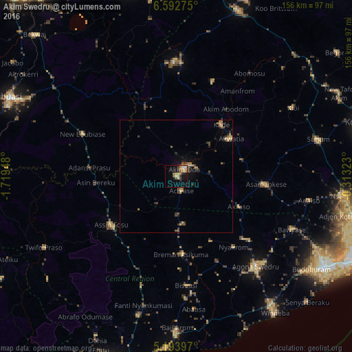
Analysis of Akim Swedru night lights 2016
Square area 10x10 km:
 0.62%
0.62%90-99
1.03%80-89
7.44%70-79
5.58%60-69
2.69%50-59
2.27%40-49
1.86%30-39
2.48%20-29
3.93%10-19
14.46%0-9
57.64%Square area 50x50 km:
0.03%90-99
0.04%80-89
0.6%70-79
0.51%60-69
0.49%50-59
0.44%40-49
0.56%30-39
0.82%20-29
0.57%10-19
1.58%0-9
94.37%Clear (daylight) street map image can be seen on geolist.org.
Map coordinates:
6° 35' 33.9" North, 1° 43' 10.1" West
5° 53' 37.7" North, 1° 0' 58.9" West
5° 11' 38.3" North, 0° 18' 47.6" West
Some cities around Akim Swedru sort by population:
• Swedru
52.9 km =32.9 mi,  138°
138°
• Suhum
64.7 km =40.2 mi,  75°
75°
• Nsawam
74.3 km =46.2 mi,  97°
97°
• Winneba
74.4 km =46.2 mi, 144°
• Asamankese
39.2 km =24.4 mi, 95°
• Akwatia
28.1 km =17.5 mi,  54°
54°
• Foso
36.8 km =22.9 mi,  234°
234°
• Kibi
59.4 km =36.9 mi,  59°
59°
2305164 (p: 10,000)
Sources (retrieved 2019-11-25):
» Earth at Night: Flat Maps 2012, 2016