Winneba night lights from space
Night Light of Winneba (Central) from space (Ghana) Src. Average luminocity for 10x10km area is 25.2541% and for 50x50km: 9.1689%.
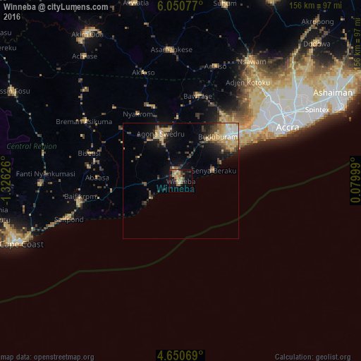
Analysis of Winneba night lights 2016
Square area 10x10 km:
100  0.41%
0.41%
90-99 1.24%
80-89 7.64%
70-79 3.1%
60-69 9.92%
50-59 2.48%
40-49 1.24%
30-39 3.93%
20-29 2.48%
10-19 20.04%
0-9 47.52%
0.41%90-99
1.24%80-89
7.64%70-79
3.1%60-69
9.92%50-59
2.48%40-49
1.24%30-39
3.93%20-29
2.48%10-19
20.04%0-9
47.52%Square area 50x50 km:
100 0.39%
90-99 1.15%
80-89 2.32%
70-79 1.57%
60-69 1.23%
50-59 0.88%
40-49 1.86%
30-39 1.25%
20-29 1.98%
10-19 5.3%
0-9 82.07%
0.39%90-99
1.15%80-89
2.32%70-79
1.57%60-69
1.23%50-59
0.88%40-49
1.86%30-39
1.25%20-29
1.98%10-19
5.3%0-9
82.07%Clear (daylight) street map image can be seen on geolist.org.
Map coordinates:
6° 3' 2.8" North, 1° 19' 34.5" West
5° 21' 4.1" North, 0° 37' 23.3" West
4° 39' 2.5" North, 0° 4' 48" East
Some cities around Winneba sort by population:
• Accra
52.4 km =32.6 mi,  64°
64°
• Atsiaman
50.5 km =31.4 mi,  40°
40°
• Swedru
22.4 km =13.9 mi,  337°
337°
• Gbawe
42.8 km =26.6 mi,  54°
54°
• Kasoa
30.6 km =19 mi, 48°
• Saltpond
50.9 km =31.6 mi,  251°
251°
• Apam
14.6 km =9.1 mi,  239°
239°
• Mumford
18 km =11.2 mi, 236°
2294034 (p: 44,254)
Sources (retrieved 2019-11-25):
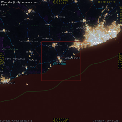
» Earth at Night: Flat Maps 2012, 2016