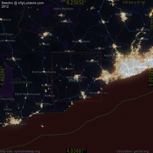
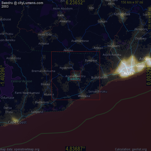
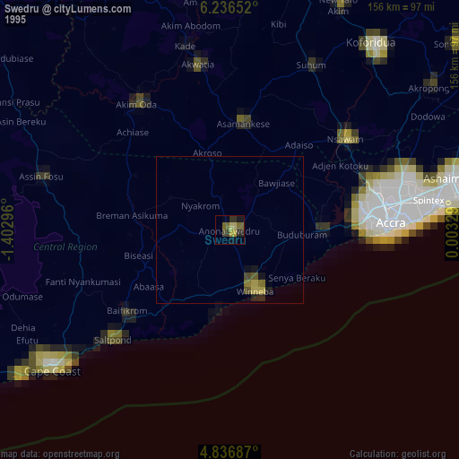
Swedru night lights from space
Night Light of Swedru (Central) from space (Ghana) Src. Average luminocity for 10x10km area is 35.469% and for 50x50km: 7.1432%.
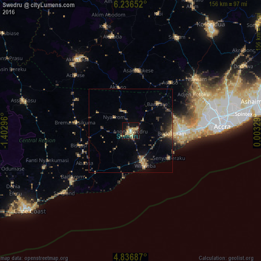
Analysis of Swedru night lights 2016
Square area 10x10 km:
 0.83%
0.83%90-99
1.65%80-89
14.46%70-79
6.82%60-69
4.55%50-59
2.27%40-49
5.37%30-39
2.48%20-29
9.3%10-19
38.22%0-9
14.05%Square area 50x50 km:
0.05%90-99
0.12%80-89
1.58%70-79
0.95%60-69
0.9%50-59
0.66%40-49
2.09%30-39
1.85%20-29
2%10-19
5.64%0-9
84.16%Clear (daylight) street map image can be seen on geolist.org.
Map coordinates:
6° 14' 11.5" North, 1° 24' 10.7" West
5° 32' 13.6" North, 0° 41' 59.4" West
4° 50' 12.7" North, 0° 0' 11.8" East
Some cities around Swedru sort by population:
• Atsiaman
44.8 km =27.8 mi,  66°
66°
• Gbawe
43.3 km =26.9 mi,  84°
84°
• Nsawam
49.1 km =30.5 mi,  51°
51°
• Winneba
22.4 km =13.9 mi,  157°
157°
• Kasoa
31.3 km =19.4 mi,  90°
90°
• Asamankese
36.1 km =22.4 mi,  6°
6°
• Apam
28.4 km =17.6 mi,  188°
188°
• Mumford
31.3 km =19.4 mi, 192°
2294962 (p: 50,293)
Sources (retrieved 2019-11-25):
» NASA, Earths city lights 1995
» NASA city lights 2003
» Earth at Night: Flat Maps 2012, 2016