Rémire-Montjoly night lights from space
Night Light of Rémire-Montjoly (Guyane) from space (French Guiana) Src. Average luminocity for 10x10km area is 40.4215% and for 50x50km: 5.2943%.
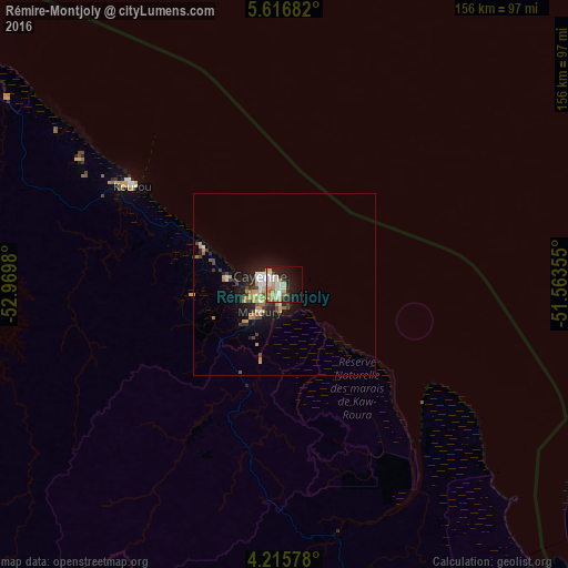
Analysis of Rémire-Montjoly night lights 2016
Square area 10x10 km:
 7.85%
7.85%90-99
9.5%80-89
3.51%70-79
11.16%60-69
3.51%50-59
2.27%40-49
2.69%30-39
0.83%20-29
9.92%10-19
25.21%0-9
23.55%Square area 50x50 km:
0.65%90-99
0.78%80-89
0.33%70-79
1.56%60-69
0.52%50-59
0.32%40-49
0.77%30-39
0.46%20-29
1.58%10-19
4.02%0-9
89%Clear (daylight) street map image can be seen on geolist.org.
Map coordinates:
5° 37' 0.6" North, 52° 58' 11.3" West
4° 55' 0" North, 52° 16' 0" West
4° 12' 56.8" North, 51° 33' 48.8" West
Some cities around Rémire-Montjoly sort by population:
• Cayenne
7.6 km =4.7 mi,  284°
284°
• Matoury
9.8 km =6.1 mi,  220°
220°
• Saint-Laurent-du-Maroni
205.7 km =127.8 mi,  288°
288°
• Kourou
49.8 km =30.9 mi,  303°
303°
• Macouria
11.9 km =7.4 mi,  267°
267°
• Moengo, SR
248.7 km =154.5 mi, 288°
• Mana
187.2 km =116.3 mi, 296°
• Albina, SR
208.3 km =129.4 mi, 288°
3380892 (p: 19,029)
Sources (retrieved 2019-11-25):
» Earth at Night: Flat Maps 2012, 2016