Cayenne night lights from space
Night Light of Cayenne (Guyane) from space (French Guiana) Src. Average luminocity for 10x10km area is 43.1178% and for 50x50km: 5.3348%.
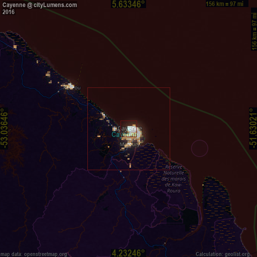

Analysis of Cayenne night lights 2016
Square area 10x10 km:
 10.12%
90-99
9.5%80-89
2.89%70-79
11.98%60-69
2.69%50-59
1.24%40-49
3.31%30-39
0.62%20-29
12.4%10-19
29.55%0-9
15.7%Square area 50x50 km:
0.65%90-99
0.78%80-89
0.33%70-79
1.61%60-69
0.52%50-59
0.28%40-49
0.77%30-39
0.48%20-29
1.58%10-19
4.02%0-9
88.97%Clear (daylight) street map image can be seen on geolist.org.
Map coordinates:
5° 38' 0.5" North, 53° 2' 11.3" West
4° 55' 60" North, 52° 19' 60" West
4° 13' 56.9" North, 51° 37' 48.8" West
Some cities around Cayenne sort by population:
• Matoury
9.4 km =5.8 mi,  173°
173°
• Saint-Laurent-du-Maroni
198.1 km =123.1 mi,  288°
288°
• Kourou
42.7 km =26.5 mi,  306°
306°
• Rémire-Montjoly
7.6 km =4.7 mi,  104°
104°
• Macouria
5.1 km =3.2 mi,  242°
242°
• Moengo, SR
241.1 km =149.8 mi, 288°
• Mana
179.7 km =111.7 mi,  297°
297°
• Albina, SR
200.7 km =124.7 mi, 288°
3382160 (p: 61,550)
Sources (retrieved 2019-11-25):
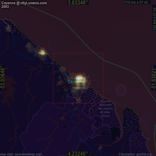
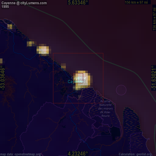
» NASA, Earths city lights 1995
» NASA city lights 2003
» Earth at Night: Flat Maps 2012, 2016