Yaxley night lights from space
Night Light of Yaxley (England) from space (United Kingdom) Src. Average luminocity for 10x10km area is 35.5172% and for 50x50km: 7.3069%.
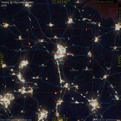
Analysis of Yaxley night lights 2016
Square area 10x10 km:
 7.67%
7.67%90-99
7.54%80-89
4.63%70-79
2.78%60-69
2.91%50-59
3.84%40-49
2.78%30-39
4.23%20-29
13.23%10-19
26.59%0-9
23.81%Square area 50x50 km:
0.99%90-99
1.18%80-89
0.76%70-79
0.72%60-69
1.05%50-59
0.98%40-49
0.82%30-39
1%20-29
1.95%10-19
4.83%0-9
85.72%Clear (daylight) street map image can be seen on geolist.org.
Map coordinates:
52° 56' 36.5" North, 0° 57' 41.9" West
52° 31' 3.6" North, 0° 15' 30.7" West
52° 5' 15.8" North, 0° 26' 40.6" East
Some cities around Yaxley sort by population:
• Peterborough
6.3 km =3.9 mi,  6°
6°
• Huntingdon
21.4 km =13.3 mi,  166°
166°
• Stamford
21.1 km =13.1 mi,  314°
314°
• Market Deeping
18.1 km =11.2 mi,  347°
347°
• Whittlesey
9.8 km =6.1 mi,  62°
62°
• Ramsey
12.6 km =7.8 mi,  126°
126°
• Oundle
14.7 km =9.1 mi,  253°
253°
• Sawtry
8.8 km =5.5 mi,  191°
191°
2633399 (p: 9,174)
Sources (retrieved 2019-11-25):
» Earth at Night: Flat Maps 2012, 2016