Market Deeping night lights from space
Night Light of Market Deeping (England) from space (United Kingdom) Src. Average luminocity for 10x10km area is 6.9339% and for 50x50km: 6.655%.
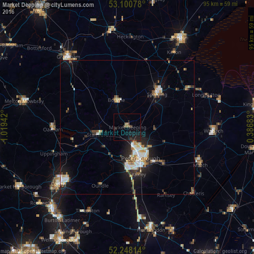
Analysis of Market Deeping night lights 2016
Square area 10x10 km:
 0%
0%90-99
0%80-89
0.53%70-79
0%60-69
1.85%50-59
1.19%40-49
0.26%30-39
1.98%20-29
3.44%10-19
10.85%0-9
79.89%Square area 50x50 km:
1.08%90-99
1.09%80-89
0.76%70-79
0.57%60-69
0.83%50-59
0.96%40-49
0.66%30-39
0.84%20-29
1.91%10-19
4.27%0-9
87.03%Clear (daylight) street map image can be seen on geolist.org.
Map coordinates:
53° 6' 2.8" North, 1° 1' 9.9" West
52° 40' 35.5" North, 0° 18' 58.6" West
52° 14' 53.3" North, 0° 23' 12.6" East
Some cities around Market Deeping sort by population:
• Peterborough
12.3 km =7.6 mi,  157°
157°
• Spalding
16.6 km =10.3 mi,  42°
42°
• Stamford
11.6 km =7.2 mi,  255°
255°
• Bourne
11 km =6.8 mi,  335°
335°
• Whittlesey
18.2 km =11.3 mi,  136°
136°
• Yaxley
18.1 km =11.2 mi,  167°
167°
• Holbeach
26.4 km =16.4 mi,  57°
57°
• Oundle
24 km =14.9 mi,  205°
205°
2643029 (p: 13,574)
Sources (retrieved 2019-11-25):
» Earth at Night: Flat Maps 2012, 2016