Stamford night lights from space
Night Light of Stamford (England) from space (United Kingdom) Src. Average luminocity for 10x10km area is 6.1574% and for 50x50km: 7.3807%.
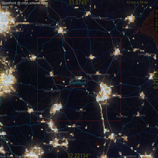
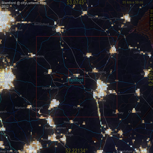
Analysis of Stamford night lights 2016
Square area 10x10 km:
 0.26%
0.26%90-99
0.79%80-89
0.53%70-79
0%60-69
1.06%50-59
0.79%40-49
2.65%30-39
2.12%20-29
1.98%10-19
0.93%0-9
88.89%Square area 50x50 km:
1.21%90-99
1.19%80-89
0.83%70-79
0.64%60-69
0.87%50-59
0.98%40-49
0.83%30-39
0.83%20-29
2.05%10-19
5.49%0-9
85.06%Clear (daylight) street map image can be seen on geolist.org.
Map coordinates:
53° 4' 28.2" North, 1° 11' 11.3" West
52° 39' 0" North, 0° 28' 60" West
52° 13' 16.8" North, 0° 13' 11.2" East
Some cities around Stamford sort by population:
• Peterborough
18 km =11.2 mi,  118°
118°
• Corby
22 km =13.7 mi,  219°
219°
• Bourne
14.6 km =9.1 mi,  27°
27°
• Market Deeping
11.6 km =7.2 mi,  75°
75°
• Whittlesey
25.9 km =16.1 mi,  113°
113°
• Oakham
17 km =10.6 mi,  276°
276°
• Yaxley
21.1 km =13.1 mi,  134°
134°
• Oundle
18.8 km =11.7 mi,  176°
176°
2637104 (p: 20,592)
Sources (retrieved 2019-11-25):
» Earth at Night: Flat Maps 2012, 2016