Ramsey night lights from space
Night Light of Ramsey (England) from space (United Kingdom) Src. Average luminocity for 10x10km area is 0.6987% and for 50x50km: 8.2456%.
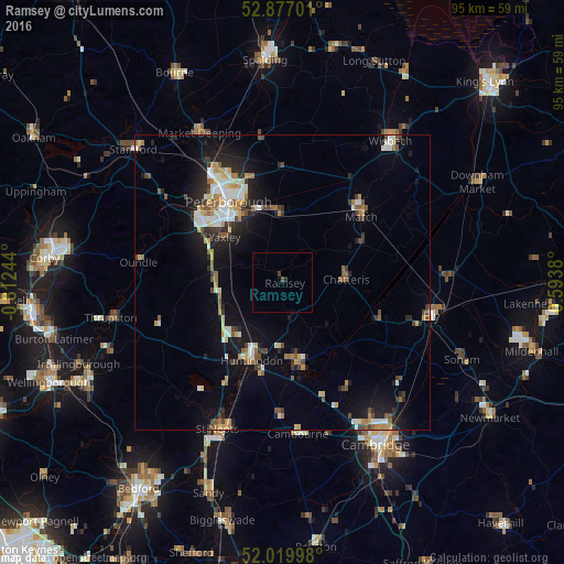
Analysis of Ramsey night lights 2016
Square area 10x10 km:
 0%
0%90-99
0%80-89
0%70-79
0%60-69
0%50-59
0.52%40-49
0.26%30-39
0.26%20-29
0.52%10-19
0%0-9
98.44%Square area 50x50 km:
1.1%90-99
1.31%80-89
0.83%70-79
0.88%60-69
1.09%50-59
1.02%40-49
0.99%30-39
1.06%20-29
2.23%10-19
5.74%0-9
83.75%Clear (daylight) street map image can be seen on geolist.org.
Map coordinates:
52° 52' 37.2" North, 0° 48' 44.8" West
52° 27' 2.1" North, 0° 6' 33.6" West
52° 1' 11.9" North, 0° 35' 37.7" East
Some cities around Ramsey sort by population:
• Peterborough
16.6 km =10.3 mi,  325°
325°
• Huntingdon
14.3 km =8.9 mi,  201°
201°
• March
17.4 km =10.8 mi,  50°
50°
• Whittlesey
12 km =7.5 mi,  353°
353°
• Chatteris
11 km =6.8 mi,  86°
86°
• Yaxley
12.6 km =7.8 mi,  306°
306°
• Godmanchester
15.3 km =9.5 mi, 197°
• Sawtry
11.9 km =7.4 mi,  264°
264°
2639664 (p: 7,829)
Sources (retrieved 2019-11-25):
» Earth at Night: Flat Maps 2012, 2016