Oundle night lights from space
Night Light of Oundle (England) from space (United Kingdom) Src. Average luminocity for 10x10km area is 0.9722% and for 50x50km: 11.1091%.
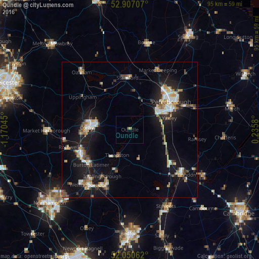
Analysis of Oundle night lights 2016
Square area 10x10 km:
 0%
0%90-99
0%80-89
0.51%70-79
0%60-69
0%50-59
0.51%40-49
0.51%30-39
0%20-29
0%10-19
0%0-9
98.48%Square area 50x50 km:
1.57%90-99
1.75%80-89
1.19%70-79
0.99%60-69
1.4%50-59
1.49%40-49
1.38%30-39
1.28%20-29
2.53%10-19
10.59%0-9
75.82%Clear (daylight) street map image can be seen on geolist.org.
Map coordinates:
52° 54' 25.5" North, 1° 10' 13.6" West
52° 28' 51.3" North, 0° 28' 2.4" West
52° 3' 2.2" North, 0° 14' 8.9" East
Some cities around Oundle sort by population:
• Peterborough
18.1 km =11.2 mi,  55°
55°
• Corby
15.1 km =9.4 mi,  276°
276°
• Stamford
18.8 km =11.7 mi,  356°
356°
• Yaxley
14.7 km =9.1 mi,  73°
73°
• Raunds
15.9 km =9.9 mi,  197°
197°
• Thrapston
10.6 km =6.6 mi,  207°
207°
• Burton Latimer
19.4 km =12.1 mi,  227°
227°
• Sawtry
13.2 km =8.2 mi,  110°
110°
2640825 (p: 5,735)
Sources (retrieved 2019-11-25):
» Earth at Night: Flat Maps 2012, 2016