Wolverhampton night lights from space
Night Light of Wolverhampton (England) from space (United Kingdom) Src. Average luminocity for 10x10km area is 85.1627% and for 50x50km: 37.5254%.
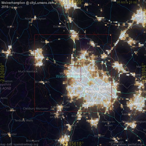
Analysis of Wolverhampton night lights 2016
Square area 10x10 km:
 42.33%
90-99
23.02%80-89
5.29%70-79
5.95%60-69
8.47%50-59
3.97%40-49
4.37%30-39
3.17%20-29
3.44%10-19
0%0-9
0%Square area 50x50 km:
12.2%90-99
10.19%80-89
3.42%70-79
3.54%60-69
3.29%50-59
2.89%40-49
3.31%30-39
3.1%20-29
5.53%10-19
11.41%0-9
41.12%Clear (daylight) street map image can be seen on geolist.org.
Map coordinates:
53° 0' 38.1" North, 2° 49' 33.9" West
52° 35' 7.7" North, 2° 7' 22.7" West
52° 9' 22.2" North, 1° 25' 11.4" West
Some cities around Wolverhampton sort by population:
• Tipton
7.3 km =4.5 mi,  149°
149°
• Bloxwich
8.8 km =5.5 mi,  65°
65°
• Wednesfield
2.8 km =1.7 mi,  64°
64°
• Willenhall
4.3 km =2.7 mi,  90°
90°
• Wednesbury
7.7 km =4.8 mi,  119°
119°
• Featherstone
6.9 km =4.3 mi,  16°
16°
• Wombourn
7.1 km =4.4 mi,  215°
215°
• Codsall
7.2 km =4.5 mi,  312°
312°
2633691 (p: 252,791)
Sources (retrieved 2019-11-25):
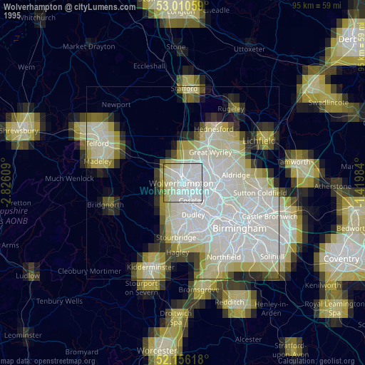
» NASA, Earths city lights 1995
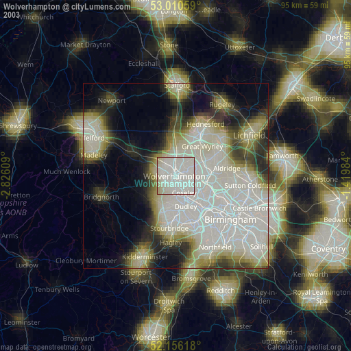
» NASA city lights 2003
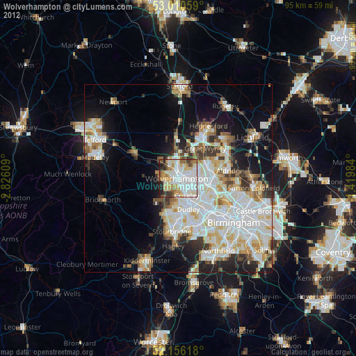
» Earth at Night: Flat Maps 2012, 2016