Willenhall night lights from space
Night Light of Willenhall (England) from space (United Kingdom) Src. Average luminocity for 10x10km area is 96.9974% and for 50x50km: 39.1795%.
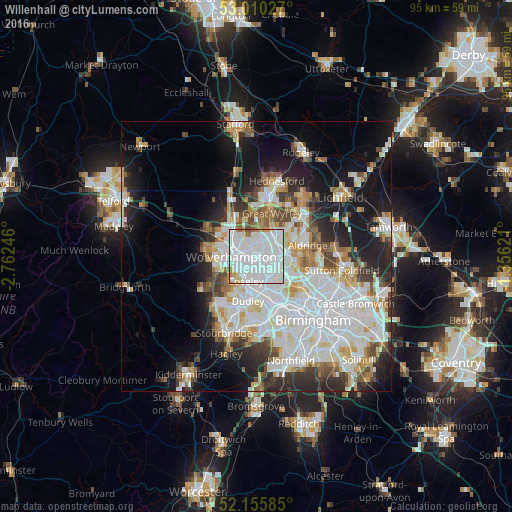
Analysis of Willenhall night lights 2016
Square area 10x10 km:
 62.3%
62.3%90-99
29.5%80-89
2.25%70-79
2.78%60-69
1.85%50-59
1.06%40-49
0.26%30-39
0%20-29
0%10-19
0%0-9
0%Square area 50x50 km:
12.67%90-99
10.41%80-89
3.39%70-79
3.61%60-69
3.52%50-59
3%40-49
3.57%30-39
3.45%20-29
6.79%10-19
12.51%0-9
37.08%Clear (daylight) street map image can be seen on geolist.org.
Map coordinates:
53° 0' 37" North, 2° 45' 44.9" West
52° 35' 6.5" North, 2° 3' 33.6" West
52° 9' 21.1" North, 1° 21' 22.4" West
Some cities around Willenhall sort by population:
• Wolverhampton
4.3 km =2.7 mi,  270°
270°
• Walsall
5.1 km =3.2 mi,  89°
89°
• Tipton
6.2 km =3.9 mi,  185°
185°
• Bloxwich
5.2 km =3.2 mi,  45°
45°
• Wednesfield
2.1 km =1.3 mi,  305°
305°
• Wednesbury
4.5 km =2.8 mi,  147°
147°
• Featherstone
7 km =4.3 mi,  341°
341°
• Pelsall
7.9 km =4.9 mi, 51°
2633912 (p: 27,500)
Sources (retrieved 2019-11-25):
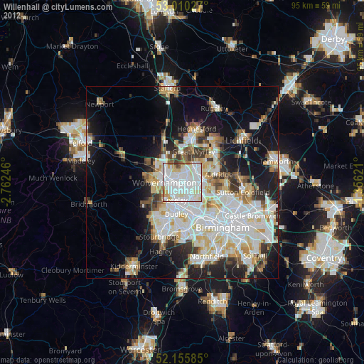
» Earth at Night: Flat Maps 2012, 2016