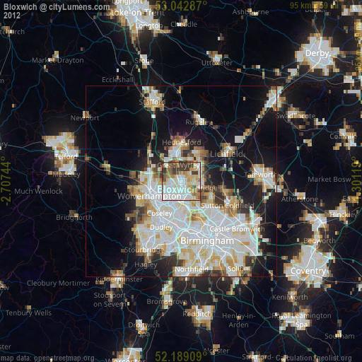
Bloxwich night lights from space
Night Light of Bloxwich (England) from space (United Kingdom) Src. Average luminocity for 10x10km area is 83.1164% and for 50x50km: 39.0939%.
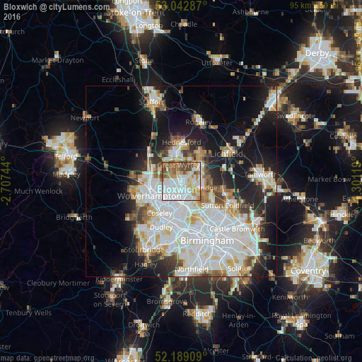
Analysis of Bloxwich night lights 2016
Square area 10x10 km:
 34.26%
90-99
21.03%80-89
6.35%70-79
10.19%60-69
9.26%50-59
9.66%40-49
9.13%30-39
0.13%20-29
0%10-19
0%0-9
0%Square area 50x50 km:
12.88%90-99
10.68%80-89
3.42%70-79
3.46%60-69
3.55%50-59
2.77%40-49
3.29%30-39
2.77%20-29
6.24%10-19
13.33%0-9
37.62%Clear (daylight) street map image can be seen on geolist.org.
Map coordinates:
53° 2' 34.3" North, 2° 42' 26.8" West
52° 37' 5" North, 2° 0' 15.5" West
52° 11' 20.7" North, 1° 18' 4.3" West
Some cities around Bloxwich sort by population:
• Walsall
3.9 km =2.4 mi,  159°
159°
• Wednesfield
6 km =3.7 mi,  246°
246°
• Willenhall
5.2 km =3.2 mi,  225°
225°
• Brownhills
5.1 km =3.2 mi,  70°
70°
• Great Wyrley
5 km =3.1 mi,  354°
354°
• Aldridge
6 km =3.7 mi,  103°
103°
• Pelsall
2.8 km =1.7 mi,  63°
63°
• Norton Canes
6.6 km =4.1 mi,  25°
25°
2655329 (p: 40,000)
Sources (retrieved 2019-11-25):
» Earth at Night: Flat Maps 2012, 2016