Tipton night lights from space
Night Light of Tipton (England) from space (United Kingdom) Src. Average luminocity for 10x10km area is 95.25% and for 50x50km: 39.937%.
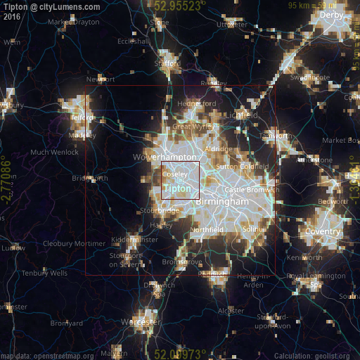
Analysis of Tipton night lights 2016
Square area 10x10 km:
 46.69%
90-99
37.17%80-89
8.33%70-79
4.1%60-69
2.65%50-59
0.93%40-49
0.13%30-39
0%20-29
0%10-19
0%0-9
0%Square area 50x50 km:
12.72%90-99
10.56%80-89
3.46%70-79
3.53%60-69
3.66%50-59
3.16%40-49
3.73%30-39
3.47%20-29
7.49%10-19
14.06%0-9
34.18%Clear (daylight) street map image can be seen on geolist.org.
Map coordinates:
52° 57' 18.8" North, 2° 46' 15.1" West
52° 31' 46.4" North, 2° 4' 3.8" West
52° 5' 59" North, 1° 21' 52.6" West
Some cities around Tipton sort by population:
• Wolverhampton
7.3 km =4.5 mi,  329°
329°
• Dudley
3.5 km =2.2 mi,  197°
197°
• West Bromwich
5.1 km =3.2 mi,  103°
103°
• Brierley Hill
6.4 km =4 mi,  214°
214°
• Willenhall
6.2 km =3.9 mi,  5°
5°
• Wednesbury
3.9 km =2.4 mi,  50°
50°
• Oldbury
4.8 km =3 mi,  133°
133°
• Cradley Heath
6.5 km =4 mi,  188°
188°
2635785 (p: 47,000)
Sources (retrieved 2019-11-25):
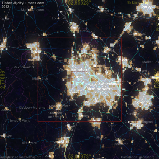
» Earth at Night: Flat Maps 2012, 2016