Warsop night lights from space
Night Light of Warsop (England) from space (United Kingdom) Src. Average luminocity for 10x10km area is 17.9331% and for 50x50km: 24.7445%.
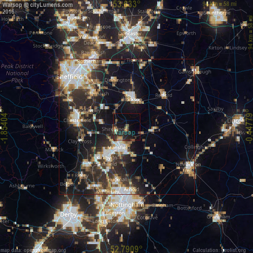
Analysis of Warsop night lights 2016
Square area 10x10 km:
 0.13%
0.13%90-99
1.14%80-89
1.77%70-79
2.53%60-69
1.64%50-59
2.53%40-49
3.66%30-39
6.06%20-29
10.1%10-19
14.52%0-9
55.93%Square area 50x50 km:
4.02%90-99
4.88%80-89
2.42%70-79
2.44%60-69
3.29%50-59
3.35%40-49
2.91%30-39
4.41%20-29
8.09%10-19
14.93%0-9
49.25%Clear (daylight) street map image can be seen on geolist.org.
Map coordinates:
53° 37' 58.8" North, 1° 51' 14.5" West
53° 12' 50.5" North, 1° 9' 3.3" West
52° 47' 27.2" North, 0° 26' 52" West
Some cities around Warsop sort by population:
• Mansfield
9.5 km =5.9 mi,  200°
200°
• Worksop
9.9 km =6.2 mi,  10°
10°
• Mansfield Woodhouse
6.2 km =3.9 mi,  207°
207°
• Bolsover
9.5 km =5.9 mi,  279°
279°
• Shirebrook
4.3 km =2.7 mi,  254°
254°
• Market Warsop
1 km =0.6 mi,  186°
186°
• Creswell
7.1 km =4.4 mi,  319°
319°
• Edwinstowe
6.2 km =3.9 mi,  110°
110°
2634736 (p: 9,766)
Sources (retrieved 2019-11-25):
» Earth at Night: Flat Maps 2012, 2016