Waltham Abbey night lights from space
Night Light of Waltham Abbey (England) from space (United Kingdom) Src. Average luminocity for 10x10km area is 56.0434% and for 50x50km: 49.6498%.
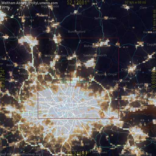
Analysis of Waltham Abbey night lights 2016
Square area 10x10 km:
 11.48%
90-99
13.17%80-89
5.74%70-79
2.8%60-69
9.94%50-59
8.82%40-49
8.54%30-39
11.62%20-29
15.13%10-19
12.75%0-9
0%Square area 50x50 km:
20.92%90-99
11.28%80-89
3.99%70-79
2.91%60-69
4.07%50-59
4.44%40-49
3.97%30-39
4.47%20-29
6.33%10-19
12.02%0-9
25.62%Clear (daylight) street map image can be seen on geolist.org.
Map coordinates:
52° 7' 14.9" North, 0° 42' 26.4" West
51° 41' 13.2" North, 0° 0' 15.2" West
51° 14' 56.4" North, 0° 41' 56.1" East
Some cities around Waltham Abbey sort by population:
• Enfield Town
6.8 km =4.2 mi,  234°
234°
• Cheshunt
2.3 km =1.4 mi,  309°
309°
• Hoddesdon
8.3 km =5.2 mi,  356°
356°
• Woodford Green
8.8 km =5.5 mi,  167°
167°
• Broxbourne
6.8 km =4.2 mi,  351°
351°
• Buckhurst Hill
7.4 km =4.6 mi,  160°
160°
• Chigwell
9.3 km =5.8 mi,  143°
143°
• Epping
8 km =5 mi,  81°
81°
2634843 (p: 18,069)
Sources (retrieved 2019-11-25):
» Earth at Night: Flat Maps 2012, 2016