Broxbourne night lights from space
Night Light of Broxbourne (England) from space (United Kingdom) Src. Average luminocity for 10x10km area is 32.1751% and for 50x50km: 38.8731%.
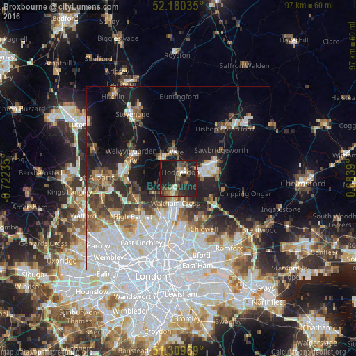
Analysis of Broxbourne night lights 2016
Square area 10x10 km:
 1.82%
1.82%90-99
1.96%80-89
3.78%70-79
1.4%60-69
4.9%50-59
6.16%40-49
6.72%30-39
9.8%20-29
22.69%10-19
38.94%0-9
1.82%Square area 50x50 km:
13.25%90-99
8.59%80-89
3.34%70-79
2.57%60-69
3.85%50-59
4.47%40-49
3.95%30-39
4.47%20-29
6.54%10-19
13.68%0-9
35.29%Clear (daylight) street map image can be seen on geolist.org.
Map coordinates:
52° 10' 49.3" North, 0° 43' 20.5" West
51° 44' 49.6" North, 0° 1' 9.2" West
51° 18' 34.9" North, 0° 41' 2" East
Some cities around Broxbourne sort by population:
• Harlow
9.6 km =6 mi,  70°
70°
• Cheshunt
5.3 km =3.3 mi,  188°
188°
• Hoddesdon
1.7 km =1.1 mi,  18°
18°
• Hertford
6.8 km =4.2 mi,  323°
323°
• Waltham Abbey
6.8 km =4.2 mi,  171°
171°
• Ware
7.1 km =4.4 mi,  354°
354°
• Epping
10.5 km =6.5 mi,  121°
121°
• Waltham Cross
6.9 km =4.3 mi, 189°
2654481 (p: 13,298)
Sources (retrieved 2019-11-25):
» Earth at Night: Flat Maps 2012, 2016