Buckhurst Hill night lights from space
Night Light of Buckhurst Hill (England) from space (United Kingdom) Src. Average luminocity for 10x10km area is 79.0709% and for 50x50km: 57.7362%.
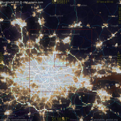
Analysis of Buckhurst Hill night lights 2016
Square area 10x10 km:
 26.74%
90-99
24.6%80-89
7.49%70-79
6.02%60-69
10.96%50-59
8.56%40-49
8.02%30-39
5.08%20-29
2.54%10-19
0%0-9
0%Square area 50x50 km:
25.48%90-99
13.52%80-89
5.19%70-79
3.73%60-69
4.21%50-59
4.42%40-49
3.83%30-39
4.51%20-29
6.83%10-19
9.75%0-9
18.53%Clear (daylight) street map image can be seen on geolist.org.
Map coordinates:
52° 3' 30.6" North, 0° 40' 13.8" West
51° 37' 26.7" North, 0° 1' 57.4" East
51° 11' 7.7" North, 0° 44' 8.7" East
Some cities around Buckhurst Hill sort by population:
• Enfield Town
8.7 km =5.4 mi,  290°
290°
• Woodford Green
1.8 km =1.1 mi,  201°
201°
• Waltham Abbey
7.4 km =4.6 mi,  340°
340°
• Grange Hill
3.9 km =2.4 mi,  110°
110°
• Chigwell
3 km =1.9 mi,  98°
98°
• Waltham Cross
8.3 km =5.2 mi,  325°
325°
• Chadwell Heath
9.1 km =5.7 mi,  130°
130°
• Hainault
5.4 km =3.4 mi, 108°
2654412 (p: 10,738)
Sources (retrieved 2019-11-25):
» Earth at Night: Flat Maps 2012, 2016