Enfield Town night lights from space
Night Light of Enfield Town (England) from space (United Kingdom) Src. Average luminocity for 10x10km area is 81.2087% and for 50x50km: 59.8364%.
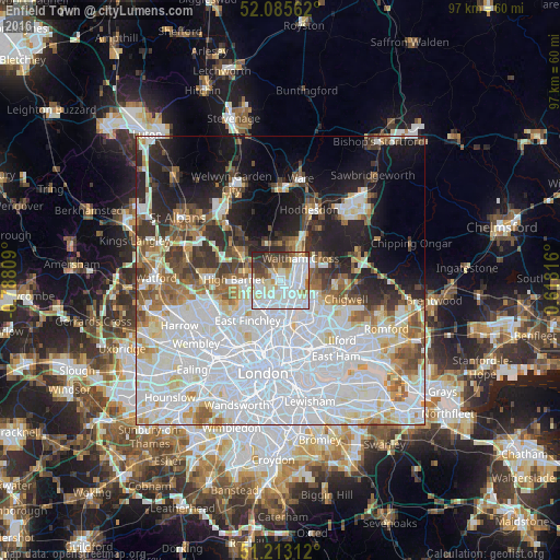
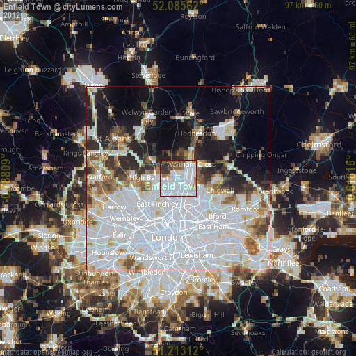
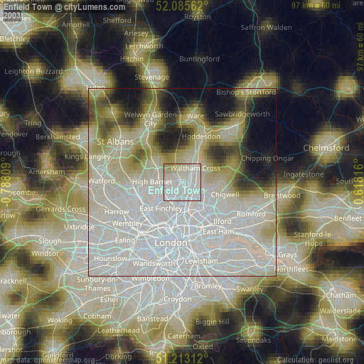
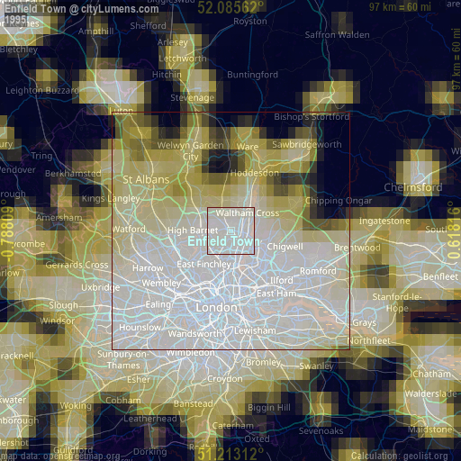
Analysis of Enfield Town night lights 2016
Square area 10x10 km:
 28.43%
90-99
30.25%80-89
9.8%70-79
3.5%60-69
3.92%50-59
5.88%40-49
6.58%30-39
8.4%20-29
3.22%10-19
0%0-9
0%Square area 50x50 km:
25.77%90-99
14.8%80-89
5.26%70-79
3.61%60-69
4.48%50-59
4.97%40-49
3.95%30-39
4.54%20-29
6.82%10-19
10.4%0-9
15.39%Clear (daylight) street map image can be seen on geolist.org.
Map coordinates:
52° 5' 8.2" North, 0° 47' 17.1" West
51° 39' 5.3" North, 0° 5' 5.9" West
51° 12' 47.2" North, 0° 37' 5.4" East
Some cities around Enfield Town sort by population:
• Cheshunt
6.6 km =4.1 mi,  34°
34°
• Barnet
7.9 km =4.9 mi,  268°
268°
• Potters Bar
8 km =5 mi,  305°
305°
• Hadley Wood
6.1 km =3.8 mi,  286°
286°
• Waltham Abbey
6.8 km =4.2 mi,  54°
54°
• Harringay
7.7 km =4.8 mi,  187°
187°
• Crouch End
8.4 km =5.2 mi,  198°
198°
• Waltham Cross
5.1 km =3.2 mi,  41°
41°
2649997 (p: 103,970)
Sources (retrieved 2019-11-25):
» NASA, Earths city lights 1995
» NASA city lights 2003
» Earth at Night: Flat Maps 2012, 2016