Cheshunt night lights from space
Night Light of Cheshunt (England) from space (United Kingdom) Src. Average luminocity for 10x10km area is 52.6261% and for 50x50km: 48.7901%.
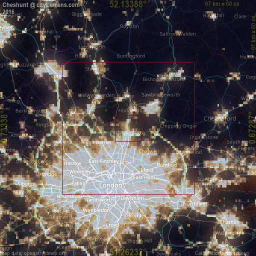
Analysis of Cheshunt night lights 2016
Square area 10x10 km:
 9.8%
9.8%90-99
11.06%80-89
5.18%70-79
2.94%60-69
8.26%50-59
9.1%40-49
9.66%30-39
13.73%20-29
18.35%10-19
11.76%0-9
0.14%Square area 50x50 km:
19.78%90-99
11.17%80-89
4.07%70-79
2.96%60-69
4.17%50-59
4.59%40-49
3.9%30-39
4.51%20-29
6.66%10-19
12.34%0-9
25.86%Clear (daylight) street map image can be seen on geolist.org.
Map coordinates:
52° 8' 2" North, 0° 44' 0.2" West
51° 42' 0.7" North, 0° 1' 48.9" West
51° 15' 44.4" North, 0° 40' 22.3" East
Some cities around Cheshunt sort by population:
• Enfield Town
6.6 km =4.1 mi,  214°
214°
• Hoddesdon
6.9 km =4.3 mi,  10°
10°
• Potters Bar
10.2 km =6.3 mi,  265°
265°
• Waltham Abbey
2.3 km =1.4 mi,  129°
129°
• Broxbourne
5.3 km =3.3 mi, 8°
• Buckhurst Hill
9.5 km =5.9 mi,  152°
152°
• Epping
9.7 km =6 mi,  91°
91°
• Waltham Cross
1.6 km =1 mi,  193°
193°
2653232 (p: 57,374)
Sources (retrieved 2019-11-25):
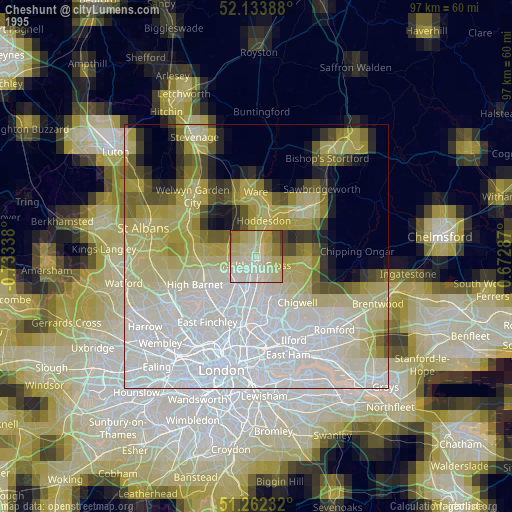
» NASA, Earths city lights 1995
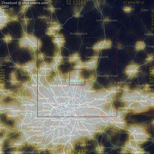
» NASA city lights 2003
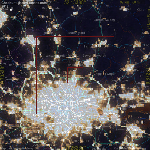
» Earth at Night: Flat Maps 2012, 2016