Stowmarket night lights from space
Night Light of Stowmarket (England) from space (United Kingdom) Src. Average luminocity for 10x10km area is 7.8532% and for 50x50km: 4.6395%.
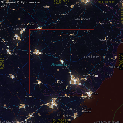
Analysis of Stowmarket night lights 2016
Square area 10x10 km:
 1.06%
1.06%90-99
1.59%80-89
0%70-79
1.46%60-69
0.66%50-59
1.06%40-49
1.06%30-39
1.59%20-29
1.32%10-19
0.26%0-9
89.95%Square area 50x50 km:
0.52%90-99
0.56%80-89
0.34%70-79
0.57%60-69
0.69%50-59
0.62%40-49
0.87%30-39
0.71%20-29
0.9%10-19
3.62%0-9
90.61%Clear (daylight) street map image can be seen on geolist.org.
Map coordinates:
52° 37' 4.4" North, 0° 17' 40.6" East
52° 11' 20.1" North, 0° 59' 51.9" East
51° 45' 20.8" North, 1° 42' 3.1" East
Some cities around Stowmarket sort by population:
• Ipswich
18 km =11.2 mi,  143°
143°
• Bury St Edmunds
20.5 km =12.7 mi,  288°
288°
• Sudbury
24.7 km =15.3 mi,  227°
227°
• Woodbridge
24.5 km =15.2 mi,  115°
115°
• Kesgrave
21.5 km =13.4 mi,  130°
130°
• Diss
22.2 km =13.8 mi,  19°
19°
• Hadleigh
16.3 km =10.1 mi,  190°
190°
• Manningtree
27.4 km =17 mi,  170°
170°
2636749 (p: 21,028)
Sources (retrieved 2019-11-25):
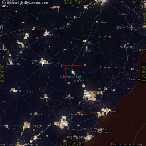
» Earth at Night: Flat Maps 2012, 2016