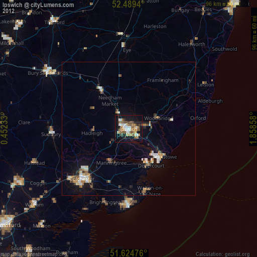
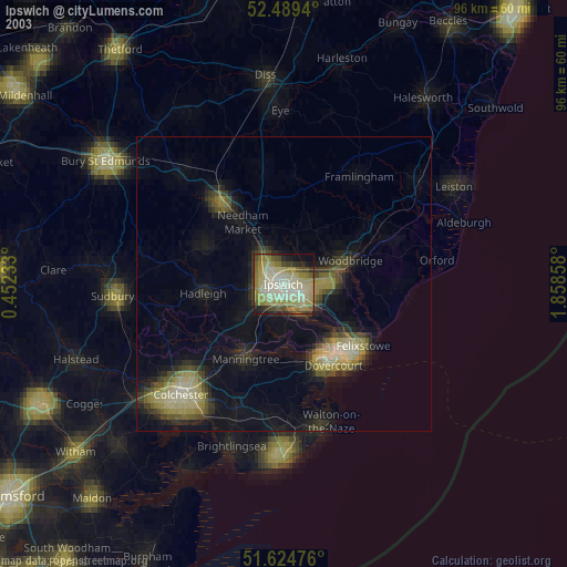
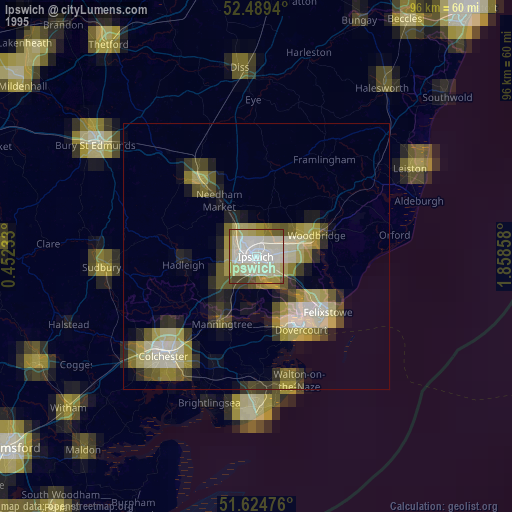
Ipswich night lights from space
Night Light of Ipswich (England) from space (United Kingdom) Src. Average luminocity for 10x10km area is 39.846% and for 50x50km: 5.9294%.
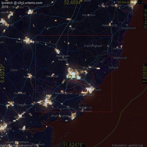
Analysis of Ipswich night lights 2016
Square area 10x10 km:
 6.31%
6.31%90-99
6.82%80-89
3.41%70-79
3.66%60-69
7.58%50-59
6.06%40-49
8.21%30-39
4.67%20-29
9.72%10-19
36.99%0-9
6.57%Square area 50x50 km:
0.77%90-99
0.88%80-89
0.42%70-79
0.58%60-69
0.79%50-59
0.8%40-49
0.92%30-39
0.9%20-29
1.23%10-19
5.53%0-9
87.18%Clear (daylight) street map image can be seen on geolist.org.
Map coordinates:
52° 29' 21.8" North, 0° 27' 8.4" East
52° 3' 33" North, 1° 9' 19.6" East
51° 37' 29.1" North, 1° 51' 30.9" East
Some cities around Ipswich sort by population:
• Felixstowe
17.1 km =10.6 mi,  128°
128°
• Stowmarket
18 km =11.2 mi,  323°
323°
• Harwich
15.7 km =9.8 mi,  145°
145°
• Walton-on-the-Naze
24.7 km =15.3 mi,  161°
161°
• Woodbridge
11.9 km =7.4 mi,  71°
71°
• Kesgrave
5.6 km =3.5 mi,  86°
86°
• Hadleigh
13.9 km =8.6 mi,  263°
263°
• Manningtree
14.2 km =8.8 mi,  207°
207°
2646057 (p: 178,835)
Sources (retrieved 2019-11-25):
» NASA, Earths city lights 1995
» NASA city lights 2003
» Earth at Night: Flat Maps 2012, 2016