Oakham night lights from space
Night Light of Oakham (England) from space (United Kingdom) Src. Average luminocity for 10x10km area is 4.4034% and for 50x50km: 5.1582%.
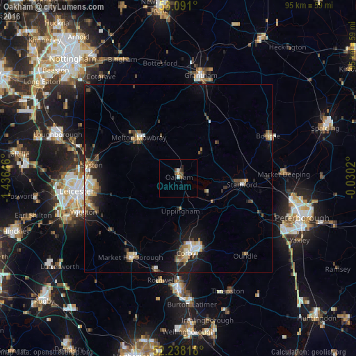
Analysis of Oakham night lights 2016
Square area 10x10 km:
 0.66%
0.66%90-99
0.4%80-89
0%70-79
0.53%60-69
0.53%50-59
2.25%40-49
0.93%30-39
0%20-29
1.06%10-19
0%0-9
93.65%Square area 50x50 km:
0.49%90-99
0.73%80-89
0.79%70-79
0.44%60-69
0.59%50-59
0.87%40-49
0.93%30-39
0.57%20-29
1.21%10-19
3.58%0-9
89.81%Clear (daylight) street map image can be seen on geolist.org.
Map coordinates:
53° 5' 27.6" North, 1° 26' 11.3" West
52° 40' 0" North, 0° 43' 60" West
52° 14' 17.4" North, 0° 1' 48.7" West
Some cities around Oakham sort by population:
• Corby
19.2 km =11.9 mi,  171°
171°
• Melton Mowbray
15.1 km =9.4 mi,  316°
316°
• Oadby
24.6 km =15.3 mi,  254°
254°
• Market Harborough
24.5 km =15.2 mi,  211°
211°
• Stamford
17 km =10.6 mi,  96°
96°
• Syston
22.5 km =14 mi,  274°
274°
• Desborough
25.7 km =16 mi,  193°
193°
• Kibworth Harcourt
22.3 km =13.9 mi,  232°
232°
2641128 (p: 10,922)
Sources (retrieved 2019-11-25):
» Earth at Night: Flat Maps 2012, 2016