Richmond night lights from space
Night Light of Richmond (England) from space (United Kingdom) Src. Average luminocity for 10x10km area is 90.5909% and for 50x50km: 64.9331%.
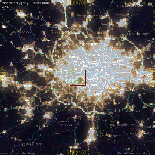
Analysis of Richmond night lights 2016
Square area 10x10 km:
 32.89%
90-99
33.42%80-89
15.37%70-79
8.96%60-69
4.14%50-59
5.21%40-49
0%30-39
0%20-29
0%10-19
0%0-9
0%Square area 50x50 km:
25.81%90-99
14.76%80-89
5.64%70-79
5.09%60-69
6.34%50-59
6.85%40-49
6.59%30-39
6.31%20-29
6.68%10-19
9.49%0-9
6.44%Clear (daylight) street map image can be seen on geolist.org.
Map coordinates:
51° 53' 51.6" North, 1° 0' 34.1" West
51° 27' 42.2" North, 0° 18' 22.8" West
51° 1' 17.5" North, 0° 23' 48.4" East
Some cities around Richmond sort by population:
• Southall
6.9 km =4.3 mi,  319°
319°
• Hounslow
3.9 km =2.4 mi,  281°
281°
• Acton
5.7 km =3.5 mi,  21°
21°
• Isleworth
2.9 km =1.8 mi,  300°
300°
• Hampton
6.8 km =4.2 mi,  218°
218°
• Brentford
2.7 km =1.7 mi,  357°
357°
• Kingston upon Thames
5.5 km =3.4 mi,  173°
173°
• Teddington
4.7 km =2.9 mi,  200°
200°
2639389 (p: 8,360)
Sources (retrieved 2019-11-25):
» Earth at Night: Flat Maps 2012, 2016