Isleworth night lights from space
Night Light of Isleworth (England) from space (United Kingdom) Src. Average luminocity for 10x10km area is 94.1052% and for 50x50km: 63.3742%.
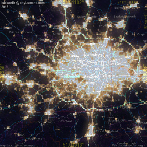
Analysis of Isleworth night lights 2016
Square area 10x10 km:
 40%
40%90-99
38.96%80-89
11.56%70-79
5.06%60-69
1.95%50-59
2.47%40-49
0%30-39
0%20-29
0%10-19
0%0-9
0%Square area 50x50 km:
24.3%90-99
13.82%80-89
5.45%70-79
5.1%60-69
6.46%50-59
7.1%40-49
6.97%30-39
6.87%20-29
7.48%10-19
11.22%0-9
5.24%Clear (daylight) street map image can be seen on geolist.org.
Map coordinates:
51° 54' 39.7" North, 1° 2' 44.1" West
51° 28' 30.6" North, 0° 20' 32.9" West
51° 2' 6.5" North, 0° 21' 38.4" East
Some cities around Isleworth sort by population:
• Southall
4.3 km =2.7 mi,  332°
332°
• Hounslow
1.5 km =0.9 mi,  239°
239°
• Acton
5.9 km =3.7 mi,  50°
50°
• Greenford
6 km =3.7 mi,  351°
351°
• Feltham
5.9 km =3.7 mi, 236°
• Brentford
2.7 km =1.7 mi,  62°
62°
• Teddington
5.9 km =3.7 mi,  171°
171°
• Richmond
2.9 km =1.8 mi,  120°
120°
2646004 (p: 20,500)
Sources (retrieved 2019-11-25):
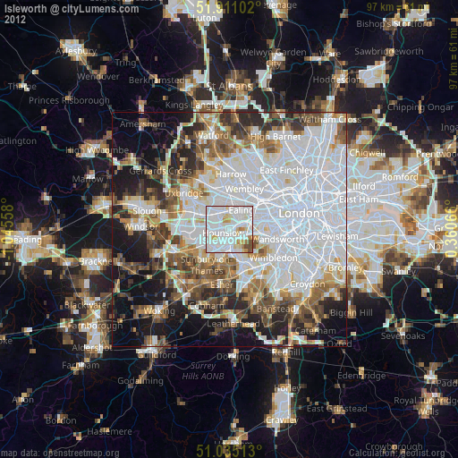
» Earth at Night: Flat Maps 2012, 2016