Hounslow night lights from space
Night Light of Hounslow (England) from space (United Kingdom) Src. Average luminocity for 10x10km area is 94.4452% and for 50x50km: 62.3301%.
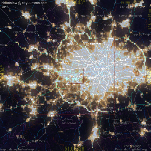
Analysis of Hounslow night lights 2016
Square area 10x10 km:
 39.71%
90-99
38.1%80-89
12.83%70-79
7.09%60-69
2.01%50-59
0.27%40-49
0%30-39
0%20-29
0%10-19
0%0-9
0%Square area 50x50 km:
23.64%90-99
13.59%80-89
5.2%70-79
5.02%60-69
6.32%50-59
7.13%40-49
7.03%30-39
6.86%20-29
7.78%10-19
11.78%0-9
5.66%Clear (daylight) street map image can be seen on geolist.org.
Map coordinates:
51° 54' 15.5" North, 1° 3' 50.5" West
51° 28' 6.2" North, 0° 21' 39.3" West
51° 1' 41.8" North, 0° 20' 32" East
Some cities around Hounslow sort by population:
• Southall
4.6 km =2.9 mi,  350°
350°
• Greenford
6.7 km =4.2 mi,  3°
3°
• Feltham
4.4 km =2.7 mi,  236°
236°
• Isleworth
1.5 km =0.9 mi,  59°
59°
• Hampton
6.1 km =3.8 mi,  183°
183°
• Brentford
4.1 km =2.5 mi, 61°
• Teddington
5.5 km =3.4 mi,  157°
157°
• Richmond
3.9 km =2.4 mi,  101°
101°
2646517 (p: 66,292)
Sources (retrieved 2019-11-25):
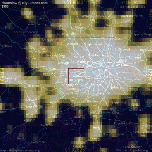
» NASA, Earths city lights 1995
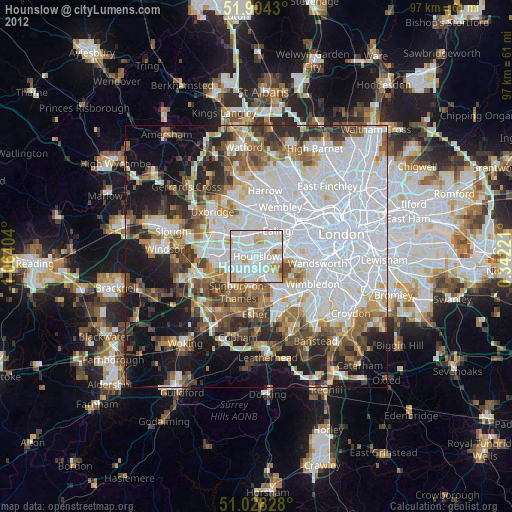
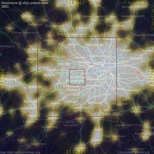
» NASA city lights 2003
» Earth at Night: Flat Maps 2012, 2016