Peasedown Saint John night lights from space
Night Light of Peasedown Saint John (England) from space (United Kingdom) Src. Average luminocity for 10x10km area is 8.1176% and for 50x50km: 12.4558%.
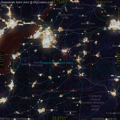
Analysis of Peasedown Saint John night lights 2016
Square area 10x10 km:
 0%
0%90-99
0.84%80-89
0.28%70-79
0.42%60-69
0.7%50-59
3.08%40-49
3.22%30-39
1.4%20-29
1.4%10-19
2.1%0-9
86.55%Square area 50x50 km:
1.94%90-99
2.32%80-89
1.35%70-79
1.27%60-69
1.65%50-59
2%40-49
1.99%30-39
1.47%20-29
2.64%10-19
4.72%0-9
78.64%Clear (daylight) street map image can be seen on geolist.org.
Map coordinates:
51° 45' 14.5" North, 3° 7' 38.3" West
51° 19' 0" North, 2° 25' 27" West
50° 52' 30.4" North, 1° 43' 15.8" West
Some cities around Peasedown Saint John sort by population:
• Bath
7.8 km =4.8 mi,  33°
33°
• Kingswood
16.2 km =10.1 mi,  338°
338°
• Trowbridge
15 km =9.3 mi,  89°
89°
• Frome
12.1 km =7.5 mi,  144°
144°
• Keynsham
12 km =7.5 mi,  334°
334°
• Midsomer Norton
5.5 km =3.4 mi,  231°
231°
• Bradford-on-Avon
12.5 km =7.8 mi,  74°
74°
• Radstock
4 km =2.5 mi,  218°
218°
3345396 (p: 6,263)
Sources (retrieved 2019-11-25):
» Earth at Night: Flat Maps 2012, 2016