Bath night lights from space
Night Light of Bath (England) from space (United Kingdom) Src. Average luminocity for 10x10km area is 17.8417% and for 50x50km: 12.8039%.
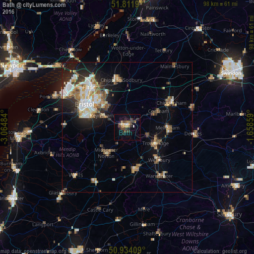
Analysis of Bath night lights 2016
Square area 10x10 km:
 1.12%
1.12%90-99
1.68%80-89
0.98%70-79
2.52%60-69
2.24%50-59
2.66%40-49
5.04%30-39
5.04%20-29
5.32%10-19
7.28%0-9
66.11%Square area 50x50 km:
1.99%90-99
2.36%80-89
1.28%70-79
1.37%60-69
1.61%50-59
1.98%40-49
1.81%30-39
1.7%20-29
3.22%10-19
5.75%0-9
76.93%Clear (daylight) street map image can be seen on geolist.org.
Map coordinates:
51° 48' 42.8" North, 3° 3' 53.4" West
51° 22' 30.4" North, 2° 21' 42.2" West
50° 56' 2.7" North, 1° 39' 30.9" West
Some cities around Bath sort by population:
• Kingswood
13.3 km =8.3 mi,  310°
310°
• Trowbridge
12.3 km =7.6 mi,  120°
120°
• Keynsham
10.4 km =6.5 mi,  294°
294°
• Neston
11.9 km =7.4 mi,  69°
69°
• Midsomer Norton
13.2 km =8.2 mi,  220°
220°
• Bradford-on-Avon
8.3 km =5.2 mi,  111°
111°
• Peasedown Saint John
7.8 km =4.8 mi,  213°
213°
• Radstock
11.8 km =7.3 mi, 215°
2656173 (p: 94,782)
Sources (retrieved 2019-11-25):
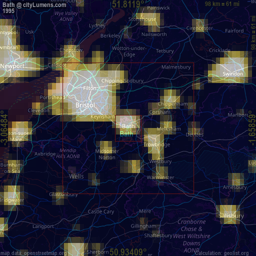
» NASA, Earths city lights 1995
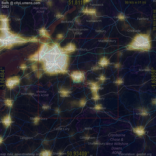
» NASA city lights 2003
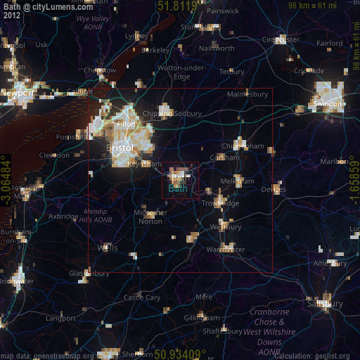
» Earth at Night: Flat Maps 2012, 2016