Oxford night lights from space
Night Light of Oxford (England) from space (United Kingdom) Src. Average luminocity for 10x10km area is 52.5672% and for 50x50km: 8.5956%.
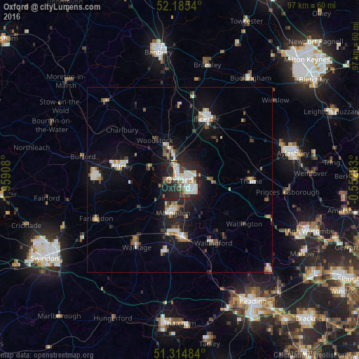
Analysis of Oxford night lights 2016
Square area 10x10 km:
 11.9%
11.9%90-99
15.83%80-89
5.04%70-79
3.64%60-69
3.78%50-59
2.66%40-49
9.38%30-39
3.78%20-29
24.79%10-19
19.05%0-9
0.14%Square area 50x50 km:
1.15%90-99
1.77%80-89
0.74%70-79
0.68%60-69
0.88%50-59
0.83%40-49
1.28%30-39
0.95%20-29
2.76%10-19
6.67%0-9
82.29%Clear (daylight) street map image can be seen on geolist.org.
Map coordinates:
52° 11' 7.4" North, 1° 57' 32.7" West
51° 45' 8" North, 1° 15' 21.5" West
51° 18' 53.4" North, 0° 33' 10.2" West
Some cities around Oxford sort by population:
• Abingdon
9.2 km =5.7 mi,  191°
191°
• Bicester
17.9 km =11.1 mi,  23°
23°
• Didcot
15.9 km =9.9 mi,  176°
176°
• Witney
16.2 km =10.1 mi,  282°
282°
• Cowley
4.1 km =2.5 mi,  123°
123°
• Kidlington
8 km =5 mi,  343°
343°
• Benson
17.8 km =11.1 mi,  145°
145°
• Wheatley
8 km =5 mi,  93°
93°
2640729 (p: 171,380)
Sources (retrieved 2019-11-25):
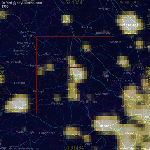
» NASA, Earths city lights 1995
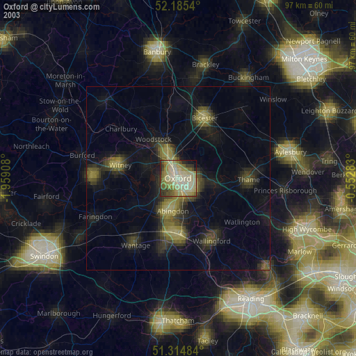
» NASA city lights 2003
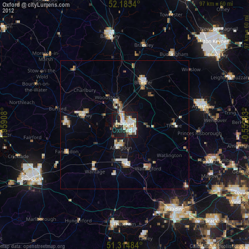
» Earth at Night: Flat Maps 2012, 2016